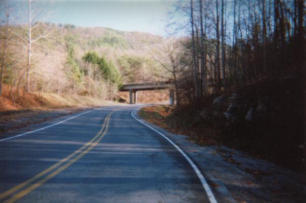
This is looking south along the short portion of old US 25E that remains in service as Sugar Run Road. Off to the left, out of the picture, is the road to Sugar Run. The overpass is Pinnacle Road, heading up to the old forts and a parking area. The old 1921 tour book mentions a road leading up to the summit. My best gues has it where the overpass is today. Going from US 25E straight up the mountain would have been quite an exciting drive. According to Mr. Porter, just above the intersection of Sugar Run Road with Old 25-E (Just off the left side of the picture) is an old pulloff that used be an overlook. The stone wall is still there and can be seen if you're coming up to 25-E from the Sugar Run area. It's up the hillside to your left right before the road curves to meet 25-E. The road leading up to the summit (Skyline Drive) for the most part is still used today. Before the park, you would go to the gap and turn there up the mountain. If you look carefully you can still see the roadbed going up from the gap. You had to pay to go up the road to the Pinnacle and there was a gift shop there as well. (Image 11 of 33)
<< Begin < Back Next > End >>