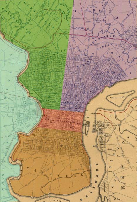
Click on one of the colored districts on the map below to see a listing of images from the Ashmead Scrapbook Collection for that district. Please see the table below map for a description of the district boundaries.
For areas outside of Philadelphia, click HERE.
To view a listing of images with unknown locations, click HERE.
To view a Master List of the images, click HERE.
|
Northeast -- North of Vine St, East of Broad St, West of Delaware River |
| Northwest -- North of Vine St, West of Broad St, East of Schuylkill River |
| West -- West of Schuylkill River |
| South -- South of South Street, Delaware River to Schuylkill River |
| Center City -- Vine St to South St and Delaware River to Schuylkill River |
|
|
|
|
Sources: Map from http://memory.loc.gov/ammem/ammemhome.html. Dedicated to the city of Philadelphia by the directors of the Pennsylvania Railroad Company. The red lines show the proposed location of the different railroads entering the city.
Hoxsie, S. K. Philadelphia (1858). CALL NUMBER G3824.P5P3 1858 .H6 RR 294 Library of Congress Geography and Map Division Washington, D.C. 20540-4650 USA