

|
| [ Previous ] [ Next ] |
|

We arrived at Cowpens National Battlefield just after noon, in time to rendezvous with a friend and fellow RevWar fan, Susan Jones, who was attending university nearby. Cowpens seemed like a good place to start our Tarleton tour. After all, if you could ask Banastre I'm sure he would say that from Cowpens there is nowhere to go but up!
We didn't make arrangements ahead of time, but we were lucky enough to find John Robertson present and willing to give us the grand tour. John is a voluble and interesting speaker. He left the Visitor Center with only the five of us in tow, but before he'd even finished his introductory spiel and taken us out onto the field, he'd snared the attention of another half-dozen passersby, who tagged along for portions of the walk.
John's interpretation of the battle is refreshingly up-to-date (unlike many of the signs still posted around the site). He agrees with modern researchers such as Lawrence Babits and Bobby Moss on the numbers present at the battle. (I.e., Daniel Morgan had the advantage in men, not the other way around. But Morgan reduced his headcount drastically in his reports.) John also supports Babits' view on how the events are reported in Ban's Campaigns. ("Tarleton told the truth, whenever he knew it.") All this made it an especially pleasant tour for those of us who are prone to take umbrage whenever we hear a rehashing of the old interpretations of Cowpens. [If you ever read this, John, both I and my blood pressure thank you for a most enjoyable afternoon. :-)]
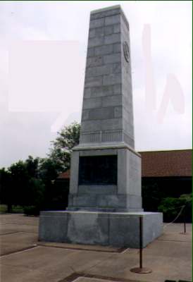
| This monument, dedicated in 1932, stands in front of the Visitors' Center at the park, and is the first thing you see as you approach. According to Daniel Barefoot, it was originally situated out on the field, and moved to its current location in the 1970s. The face shown lists the British and loyalist units present at the battle; the opposing side, facing the Visitors' Center itself, lists Morgan's forces.1 |
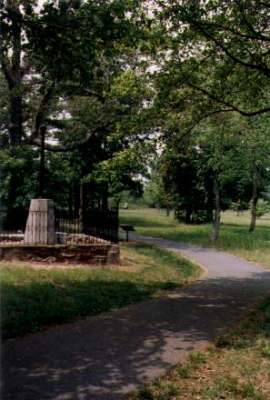
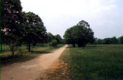
| Because of how the park is arranged, a walk out from the visitor center brings you first to the area where William Washington's cavalry assembled. The spot is marked by a 19th century monument. If you look very closely in the background of the photo, just about dead center, you will see a horse and rider crossing on one of the distant trails. There were "no horses" signs posted all around the site, but this person was cheekily ignoring them -- either that or the site is haunted, even on sunny spring days. (Unfortunately, while the latter would be a far more interesting explanation, I suspect the rider's T-shirt and jeans pretty much rule it out as a possibility.) |
|
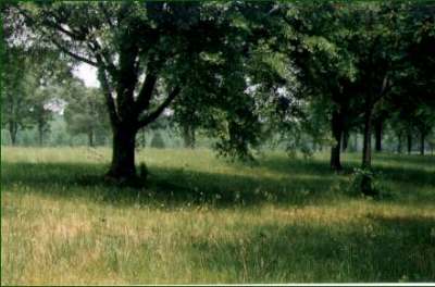
Cowpens was our first lesson on a theme that must drive insane those public relations people who are involved in marketing South Carolina's RevWar history to tourists. There isn't much in the way of exciting tangible relics to photograph. (Read: none.) It's a very pretty area, but there are trees and a few open areas, and they all look alike. I know I took a photograph of where Morgan formed up his lines -- the next stop on John's tour -- but three weeks later, I'm not sure which of three near-identical photographs of trees was it!
From there we looped around the side of the battlefield itself -- the left-hand side from Tarleton's perspective -- following a line of what was identified as swamp in 1781. Nowadays, it's dry, marked only by a line of forest and dense undergrowth. That's pretty much the tale with all of the areas we visited. The swampland mentioned all over RevWar accounts is now dry, solid fields.
| There is considerable controversy over where on the field the British dead were buried. I've been told that the acidic quality of the ground rules out the usefulness of ground soundings, so a final answer may never be found. This pretty and tranquil area is where John Robertson believes their graves lie -- the area where the fighting was worst, and where so many of them died. |
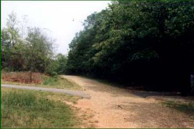
| The British forces approached the field roughly along the route where this trail runs today. Near here, they left their baggage train and formed up, facing Morgan's militia across an open field. |
|
| This is Tarleton's line of sight on the battlefield. John tells us that the parks service have replanted trees and generally tried to set up the area to look as it did in 1781, so the treeline in the distance approximates the position of the Continental line. The field gives an illusion of being open and flat, but once you've walked it you can better understand how Morgan pulled off his trap. Even when Susan climbed atop a park bench to mimic the sight line of a man on horseback, she couldn't see people on foot by the treeline. Add early morning light, mist rising from the semi-frozen ground, the smoke of gunfire, and a milling line of militia, and the Continentals could easily have been occluded from view. As John commented, Tarleton may never have even seen them. |
From here we returned to the Visitors' Center to do some shopping and check out their various exhibits, then piled back into the SUV and headed off for King's Mountain, which is only about a half hour's drive away. (Or, rather, it would have been if the highway in between hadn't been under construction!) Our visit there was too brief by necessity, since by the time we arrived, we only had about an hour to take a quick look around before the park closed.
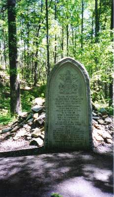
| The area is beautiful and well worth a leisurely day of exploring. But because we were in a rush, we ignored the signed trails and made our way directly to the beautiful little hollow in the forest where Patrick Ferguson and Virginia Sal are buried. Pattie wasn't in a mood to be photographed that day. I took a shot of his gravestone, but it was the first one on the film roll and didn't come out. This photo is courtesy of Stac, who visited the site a few months later and had better luck! |
|
|
Unlike the open, rolling fields of Cowpens, King's Mountain is rocky,
uneven ground with a dense covering of trees.
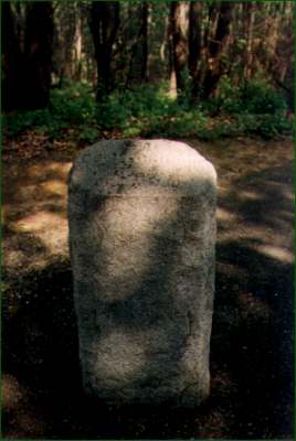
From Ferguson's grave, we continued up onto the crest of the hill itself, where the approximate location of his death is indicated by this simple stone marker. This was as far as we got into the park before turning around and making our way back to the Visitors' Center. Definitely a trip for another time! For a longer description of the park and more photos, check out Doc M's site. [see links] She describes her visit here in 1999 in more detail. |
We stayed the night near King's Mountain, and sampled the food in a local greasy spoon. (There weren't a lot of alternatives in the neighborhood.) The food was pretty good (and very plentiful) but the keynote on the menu was definitely "deep fried." If you wanted anything else, you were in the wrong restaurant. Possibly in the wrong county. Janie's comment was that we should give thanks they hadn't deep-fried the salad.
The next morning, we headed on to Brattonsville.
| [ Index ] | [ Previous ] [ Next ] |
1 See Daniel W. Barefoot, Touring South Carolina's Revolutionary War Sites (Winston-Salem, North Carolina: John F. Blair Publisher, 1999). [ back ]
| Return to the Main Page | Last updated by the Webmaster on January 30, 2004 |