|
The
African-American Census
|
||
|
[
P L A C E S . A N D . P E O P L E ]
|
||
The original goal of this portion of the project was to connect surviving buildings with households listed in the census. However, because the census takers usually only included the street on which a household was located and not its specific address, it proved impossible for me to assign a property to a particular household. While we do not know in which building a household lived, we can say with reasonable certainty that the existing houses included here are among those in which these families might have lived.
The map below is based on Ernest Hexamer and William Locher's Map of the City
of Philadelphia (Philadelphia, 1854-1862). Each of the purple areas provides
a link to information about a property that was surveyed in the 1838 census
and that still exists today. These links open into a second window. While there
is a historical map showing each site's location as well as a contemporary image
the site, the information presented in each case varies depending on data that
were available.
For instance, some of the buildings discussed here were documented by the Franklin
Fire Insurance Company in the surveys they conducted between 1837 and 1899.
(The original surveys are now on file at the Historical Society of Pennsylvania.)
These surveys include written descriptions of the properties and sometimes drawings
of the buildings' ground story floor plans as well. Some contain additional
notations regarding later renovations made to the property. These surveys allow
one to conceptualize the appearances of the properties during different time
periods. For those buildings for which I have included surveys, I have transcribed
the written descriptions. I use [sic] to indicate errors in the original
surveys, while words that are illegible in the original surveys are omitted
and replaced by the notation [illegible]. Those words which are only
partially legible are indicated with a question mark. For instance, [all?].
Chains of title, which trace ownership of a property over time, were also available
for some sites through the Historical Commission of Philadelphia. This research
revealed that, for the properties investigated, none were owned by their tenants,
who were largely African-American.
It is important to note that the names of the smaller streets on which I focus have changed since the census was taken. Sites are depicted on a map which reflects the historical street names; however they are indexed by their present-day addresses.
The streets "Barley" and "Ohio" are highlighted in green on the map. Each of these street names provides a link to information about families who lived on that street, which is taken from data provided in the census. These links open into a separate window.
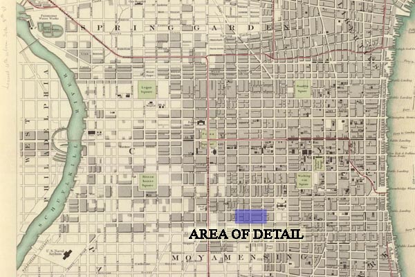
Society for the Diffusion of Useful Knowledge. Philadelphia 1840. World
Atlas.
From the David Rumsey Collection.
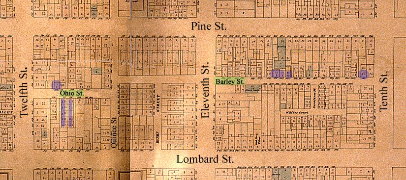
Ernest Hexamer and William Locher. Maps of the City of Philadelphia.
Volume 3, Plate 33. (Philadelphia 1858-1862).
From Places in Time website. (www.brynmawr.edu/iconog)