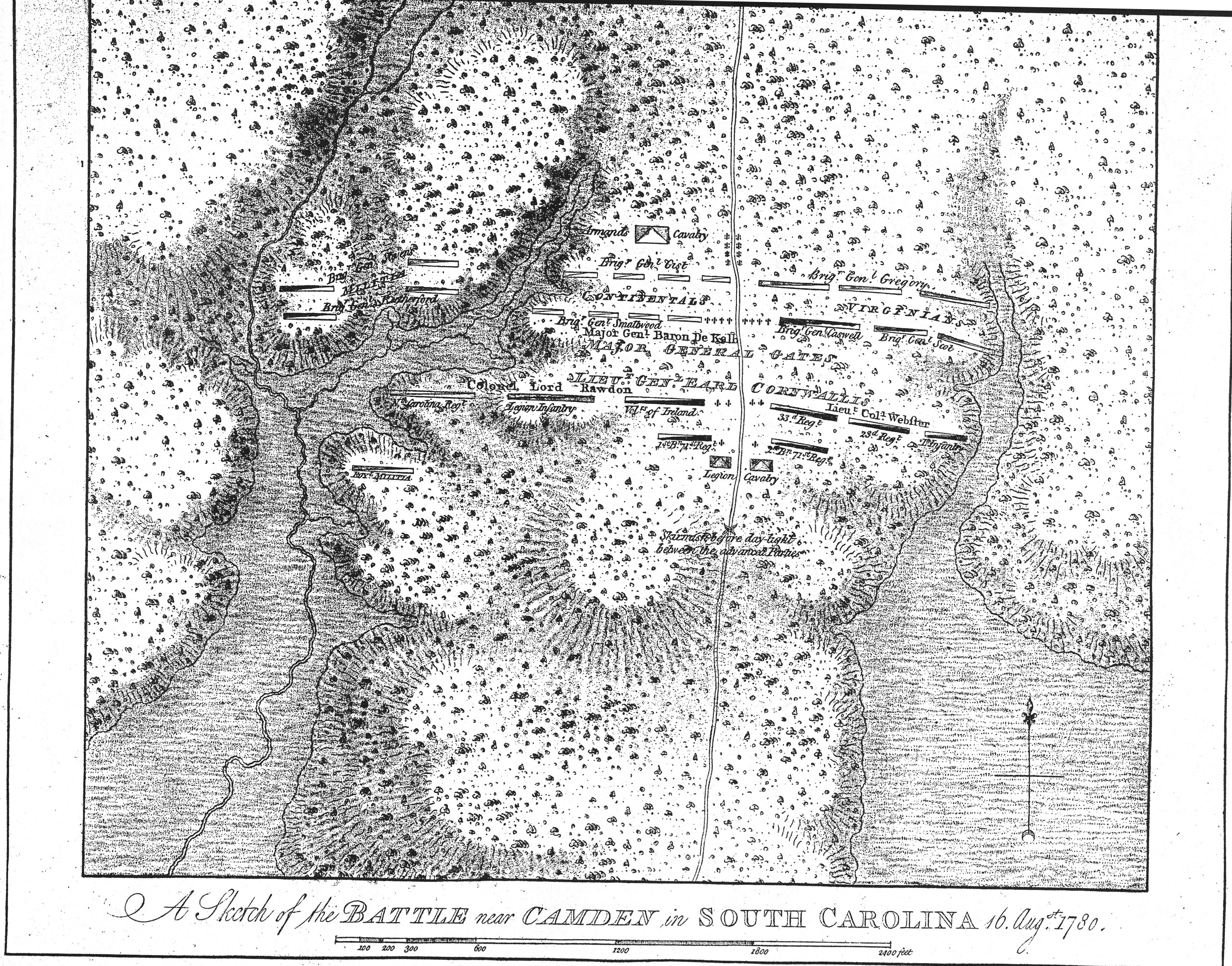
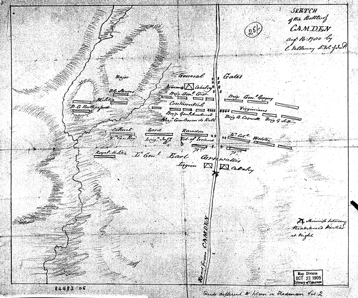
Randolph G. Adams, British Headquarters Maps and Sketches used by Sir Henry Clinton while in command of the British Forces operating in North America during the War for Independence, 1775-1782., found by Sherri Bower, says, p.318: "A Sketch of the Battle near Camden in South Carolina 16 Augst. 1780, Scale 1 inch to 400 feet. 13 x 11� inches. Manuscript. A finished, colored, topographical map showing the exact position of the two armies at the beginning of the battle. Each regiment in each army is designated, and although the coloring is inconsistent, the legends differentiate the troops clearly. In the upper right-corner Sir Henry Clinton has sketched in a few lines and noted "Second position of the right wing".
The title and dimensions exactly match that of DesBarres's map of the battle. It may be noted that DesBarre's map appears to be derived from Vallancy's map but the title shown on Vallancy's map differs.