
Continued
Pages may take a long time to download as images were left large for detail. Click on image for enlarged image.
| By 1853 Fort Wayne was bisected by the Plank Road (Bay Street). The gas works, shown at the center of the map is the present brick structure standing today. |
|
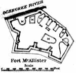
| Fort McAllister as shown on the "Poe" map. |
|
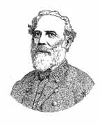
| Confederate General Robert E. Lee |
|
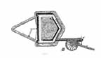
| Plan view of Fort Pulaski and the 30-pounder Parrot Rifle that helped defeat the fortification |
|
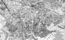
| Savannah and the surrounding area is illustrated on this 1881 map made by O.M. Poe and his staff from captured Confederate maps |
|
| A plan view of Fort Jackson on the Savannah River |
|
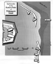
| Fort Lee, located near Fort Jackson, was a main defense of Savannah |
|
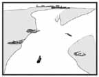
| The Gibson Point Battery, also called Eastern Point Battery, is located at the confluence of Richardson and Turner Creeks |
|