Continued
Pages may take a long time to download as images were left large for detail. Click on image for enlarged image.
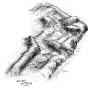
| Fort Wimberly as it looks today under its canopy of forest. This view was drawn from a basometric rendition by Dr. Lawrence Babits. |
|
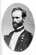
| Union General William Tecumseh Sherman |
|
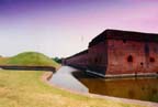
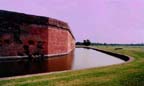
| The view down the moat between the southwest bastion and the demilune toward the drawbridge and sally port |
|
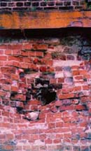
| A Union projectile is visible, at lower center, and is one of several still embedded in the masonry wall |
|
| Highlighted in harder red brick, the scar left by Union masonry worders is obvious on the southeast angle |
|
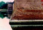
| Interlacing brickwork marks the joining of the scarp and wall of the southwest bastion. Over twenty-five million bricks were used to build fort Pulaski. |
|
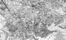
| Map of Savannah and its environs created by Union engineers from captured Confederate maps |
|
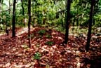
| Fieldworks, located on the Armstrong Atlantic State University campus date to the Spanish American or possible the Civil War. Further archaeological studies are expected to determine an approximate time of construciton. |
|