 US 41 / Alt US 41 /
Bus US 41 / US 94 / US 541 / Alt US 541 / Opt US 541
US 41 / Alt US 41 /
Bus US 41 / US 94 / US 541 / Alt US 541 / Opt US 541US 41 / Alt US 41 /
Bus US 41 / US 94 / US 541 / Alt US 541 / Opt US 541

 Tampa
Naples
Tampa
Naples  Tampa Bradenton Venice Fort Myers


|
US 41 | Length: 418 mi. |
| Termini: FL: State line near
Jennings to Jct US 1 in Miami or Jct FL A1A (by
sigange) in Miami Beach US: Copper Harbor, MI to Miami Beach |
Years: 1926 / present | |
| Route: US 41 is a two-lane highway from the Georgia state line to Lutz, with short four lane section around Lake City. A four lane highway mostly with a median, reaches south from there, providing intercity between the communities of Palmetto, Bradenton, Sarasota, Venice, South Venice, North Port, Port Charlotte, Punta Gorda, Fort Myers, San Carlos Park, and Naples before becoming a two lane highway agian at Belle Meade at FL 951. US 41 crosses the Everglades, then regains its four lane status at FL 997. From there it connects the growing communites of Sweetwater, Coral Gables to Miami. US 41 crosses over to Miami Beach, where it ends at FL A1A, or maybe not. | ||
| Counties: Hamilton, Columbia, Alachua, Levy, Marion, Citrus, Hernando, Pasco, Hillsborough, Manatee, Sarasota, Charlotte, Lee, Collier, Miami-Dade | ||
| "Hidden" state numbers: FL 25 State Line to High Springs, FL 45 High Springs to Tampa, FL 600 in Tampa, FL 599 Tampa to Rockport, FL 45 Rockport to Memphis, FL 55 Memphis to Bradenton, FL 45 Bradenton to Eastgate, FL 45A Eastgate to Venice Gardens, FL 45 Venice Gardens to Naples, FL 90 Naples to Miami, FL 5 in Miami, FL A1A Miami to Miami Beach | ||
| Co-signed with: |
||
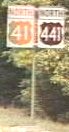
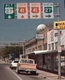
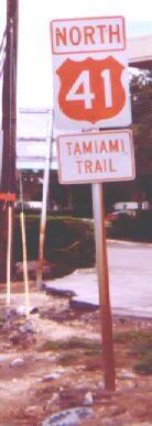
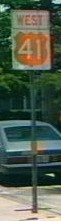
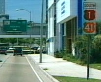
| Drive: US 41 never is on the same pavement as I-75, but the two roads are closely connected. I-75 stays within 27 miles of US-41 throughout Florida. The southern terminus of I-75 is only 14 miles from US 41. Through traffic on US 41 has been reduced to a trickle of its former volume, but US 41 still has heavy traffic in urbanized areas in its new primary use as an alternate route to I-75. The inter-urban sections are dotted by motels and old tourist traps. The old orange "I Survived US 41" bumper stickers from the late 1970's are a quickly fading memory on the old Tamiami Trail, which is still in common use term for US 41 from Tampa to Miami, featured below the route number as seen below, often along business routes as well. US 41 changes bannered direction in the Miami area, where it retains US 94's east / west desigantion. | ||


|
Alternate US 41 (Tampa) | Length: 17 mi. |
| Termini: Jct US 41 in Chapman to Jct US 41 in Rockport | Years: 1951 / 1952 | |
| Route: Short-term designation for Bus US 41 through Tampa. It is possible Florida not certain it was going to use a 'Business' designation for old US 541. | ||
| County: Hillsborough | ||
| "Hidden" state number: FL 685 down Florida Avenue, FL 60 on Kennedy / Adamo, FL 45 Ybor City to Rockport | ||
| Co-signed with: |
||
| Drive: See Bus US 41 (Tampa). With the length of this route, Alt US 41 may have been a better choice. | ||

|
Alternate US 41 (Naples) | Length: 8 mi. |
| Termini: Jct US 41 in North Naples to Jct US 41 in East Naples | Years: 1998 / 2001 | |
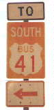
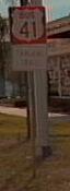
| Route: This Alt US 41 was temporary, while bridge construction occured south of downtown Naples. The banner signs denoting the route were in orange. | ||
| County: Collier | ||
| "Hidden" county numbers: CR 896 (Pine Ridge Rd), CR 31 (Airport-Pulling Rd) | ||
| Co-signed with: |
||
| Drive: This alternate of US 41 was meant as a bypass of construction, and was signed entirely on six lane county highways. The only orange used on the signs was the orange "ALT" banner. I have seen signs on an AAA Florida map that this route may have been used before in the 1970's as Temp US 41. | ||
|
Business US 41 (Tampa) | Length: 17 mi. |
| Termini: Jct US 41 in Chapman to Jct US 41 in Rockport | Years: 1952 / present | |
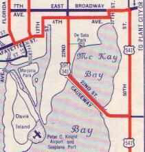
| Route: May have originally been signed and referred to as Alt US 41 (for one year or so). Bus US 41 is in Tampa, going down Florida Avenue (with a one-way pair south of Violet St. on Tampa Ave.), up Kennedy / 13th St N / Adamo Dr (FL 60) over to the 21st Street / 22nd Street one way pair. Bus 41 heads south as they join, croiing the 22nd St Causeway to Causeway Blvd. Bus 41 begins and ends at junctions with US 41. | ||
| County: Hillsborough | ||
| "Hidden state numbers: FL 685 down Florida Avenue, FL 60 on Kennedy / Adamo, FL 45 Ybor City to Rockport | ||
| Co-signed with: |
||
| Drive: Weaves through downtown Tampa, it is hard to believe it was part of a route that rated a US number of its own in 1932. To drive the original US 541 route, you have to drive northbound as much of it is a now a one-way pair. Unlike most Business US routes, this was never the route of US 41 into town. Along Ybor channel, the route's bannered direction is opposite of the travelled direction. | ||
|
Business US 41 (Bradenton) | Length: 5.6 mi. |
| Termini: Jct US 41 in Memphis to Jct US 41 in Bradenton | Years: 1960's / present | |
| Route: Down 8th Avenue West in Palmetto from an intersection with US 41, across the Green Bridge, then over to 14th Street In Bradenton, terminating at US 41 on Cortez road. | ||
| County: Manatee | ||
| "Hidden" state number: FL 45 | ||
| Co-signed with: None | ||
| Route: Bradenton has no great love for this route, and will probably seek to have it decomissioned soon to allow for placing 'traffic calming' features like roundabouts and making the area 'pedestrian friendly'. The people who use the route as a shortcut around other congestion will go back to the packs. To my thinking, you still need to provide for the cars and the drive-by traffic is important. | ||
![]()
|
Business US 41 (Venice) | Length: 3 mi. |
| Termini: Jct US 41 in Eastgate to Jct US 41 in Venice Gardens | Years: 1965 / present | |
| Route: The old alignment of the Tamiami Trail that passed though Venice, still labeled Tamiami Trail, beginning and ending at junctions with US 41. | ||
| County: Sarasota | ||
| "Hidden" state number: FL 45 | ||
| Co-signed with: None | ||
| Drive: The route is being improved to four lanes, which will require widening bridges on both ends of Bus US 41. Mainline US 41 in this area is referred to informally as "Venice Bypass." Signing the mainline as Bypass US 41 would probably not confuse the locals at all. | ||
![]()
|
Business US 41 (Fort Myers) | Length: 5.5 mi. |
| Termini: Jct US 41 in North Fort Myers to Jct US 41 in Fort Myers | Years: 1960's / present | |
| Route: The old, 1930's to 1950's era alignment of US 41. It leaves US 41, passes over the Edison Bridge, then follows FL 80 back to US 41. | ||
| County: Lee | ||
| "Hidden" state number: FL 739 from North Fort Myers to Fort Myers, FL 80 in Fort Myers | ||
| Co-signed with: |
||
| Drive: North of the Peace River, the road is mostly wide and straight, there is plenty of right of way. The formerly congested business district of North Fort Myers was drastically affected by the Bus US 41 widening, and is no long congested with twice the road and half the buildings. | ||

|
US 94 | Length: 108 mi. |
| Termini: FL / US: Jct US 41 in Naples to Jct US 1 in Miami | Years: 1926 / 1949 | |
| Route: The original assigned numbering of the Tamiami Trail between Naples and Miami, followed current US 41. Color hypothetical, US 94 was decommissioned before the coloring of US signs by Florida in 1956. Began at the end of US 41 in Naples, and ended at an intersection with US 1 in Miami. | ||
| Counties: Collier, Dade | ||
| "Hidden" state number: FL 90 | ||
| Co-signed with: None | ||
| Drive: See US 41 for this drive. Historically this route was mostly a muddy track when first assigned in 1926. Almost the entire route was built with fill dirt from canals dug (or blasted) alongside it. The route was officially opened in 1928 with much fanfare. | ||
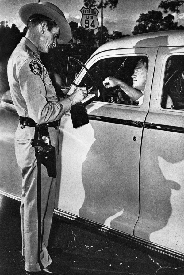
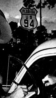 US 94 sign,
location unknown. Discovered in the Florida State
Photographic Archives by Rafael H. Perez.
US 94 sign,
location unknown. Discovered in the Florida State
Photographic Archives by Rafael H. Perez.
Actual photograph URL: http://fpc.dos.state.fl.us/general/n027371.jpg
|
US 541 | Length: 50 mi. |
| Termini: FL / US: Jct US 41 in Chapman to Jct US 41 in Palmetto | Years: 1932 / 1951 | |
| Route: The original US numbering of what was to become Business US 41 in Tampa and the road that was to become US 41 south to Palmetto. Began and ended at junctions with US 41. Color hypothetical, US 541 decommissioned before the coloring of US signs by Florida in 1956. | ||
| County: Hillsborough, Manatee | ||
| "Hidden" state numbers: FL 685 down Florida Avenue, FL 60 on Kennedy / Adamo Dr, FL 45 Ybor City to Palmetto | ||
| Was co-signed with: |
||
| See Bus US 41 Tampa and US 41 for this drive. | ||
 From Burgert Bros. collection,
Courtesy Tampa-Hillsborough County Library System. 1937
photograph of the intersection of Lafayette St (now Kennedy / FL
60) and Florida Ave in downtown Tampa in front of Smith &
Porton Gulf. Other signs on the post point to "Davis Island
Airport" and "Tampa Municipal Airport". This gas
station location is now a parking lot across the street from
Tampa City Hall.
From Burgert Bros. collection,
Courtesy Tampa-Hillsborough County Library System. 1937
photograph of the intersection of Lafayette St (now Kennedy / FL
60) and Florida Ave in downtown Tampa in front of Smith &
Porton Gulf. Other signs on the post point to "Davis Island
Airport" and "Tampa Municipal Airport". This gas
station location is now a parking lot across the street from
Tampa City Hall.
The parent photograph of the above shield: http://zerver.thpl.lib.fl.us/archive04/9685.jpg
A daylight view of the station: http://zerver.thpl.lib.fl.us/archive02/10508.jpg
|
Alternate US 541 | Length: 7 mi. |
| Termini: Jct US 541 in Tampa to Jct US 541 in Rockport | Years: 1940 / 1951 | |
| Route: This alternate route avoided the congestion of Downtown Tampa and Ybor City, utilizing the old route of US 92 and US 41, Broadway Ave. The route then went down the improved section of Bayshore to return to US 541 to 'Rockport', an area named for its Phosphate loading docks. Alt 541 began and ended at junctions with US 541. Color of sign hypothetical, Alt US 541 decommissioned before the coloring of US signs by Florida in 1956. | ||
| County: Hillsborough | ||
| "Hidden" state numbers: CR 674 down Broadway Avenue, FL 583 down Bayshore | ||
| Was co-signed with: uncertain | ||
| Drive: Part of this route is now US 41, down Bayshore, the part down Broadway is a county highway. | ||
 From a 1948 KYSO (Standard Oil of Kentucky) map of
Florida
From a 1948 KYSO (Standard Oil of Kentucky) map of
Florida
|
Optional US 541 | Length: 6 mi. |
| Termini: Jct US 541 in Ybor City to Jct US 541 in Rockport | Year: 1936 | |
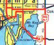
| Route: This Optional route utilized the newly constructed 22nd St Causeway. The entire route became mainline US 541. Like Alt US 541, it terminated at 'Rockport'. Opt 541 began and ended at junctions with US 541. Color of sign hypothetical, Opt US 541 decommissioned before the coloring of US signs by Florida in 1956. This was one of the first 'banner' routes in Florida. | ||
| County: Hillsborough | ||
| "Hidden" state numbers: This is now FL 45 | ||
| Was co-signed with: uncertain | ||
| Drive: This route is now part of Bus US 41, and may not have been signed in the field. | ||
![]() Click to go back to Florida in
Kodachrome
Click to go back to Florida in
Kodachrome
![]() Click here to go to the
history of US 41 in Florida Click
here for more about US 94 on the history page Click here for more about US 541 on the
history page
Click here to go to the
history of US 41 in Florida Click
here for more about US 94 on the history page Click here for more about US 541 on the
history page
Last update to this page on Monday, July 16, 2001.
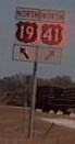
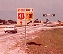
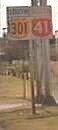
Old US 41 / 301 sign courtesy Edward J Mattes