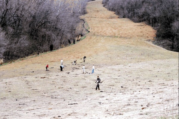
From Bill Porter: The National Park Service opened up the trail through Cumberland Gap on May 27, 2002. If you didn’t know that US-25E used to be there you never would be able to tell. This is a photo I took in March (2002). The people are LMU students who planted 20,000 trees during their spring break (in 5 days, actually) along the entire old 25E roadbed and a couple of other places. This was taken from the current highway just north of the bridge across the road to the Pinnacle. (about the place in the road in the upper left of picture #33) and looks up the old road toward the Sugar Run turnoff. Basically this is the same area you have in pictures 30, 31, 32 and 33, just from a different viewpoint. You can see where they filled in the roadbed.
This page last edited Thursday, June 20, 2002