Rivers to the West
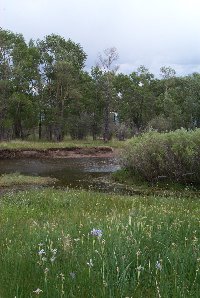
Overland Trail Crossing of the Laramie River
At the Big Laramie Stage Station
Copyright ©2000 Elizabeth Larson

Overland Trail Crossing of the Laramie River
At the Big Laramie Stage Station
Copyright ©2000 Elizabeth Larson
Rivers are woven into humanity's collective psyche. We go to a river to feel its pace and its power, whether its song is a gentle sonata or Beethoven's Fifth. Henry David Thoreau once said, "Who hears the rippling of rivers will not utterly despair of anything." We go to the river's edge for comfort, spiritual renewal, meditation, solitude; we go to the river to feel and know the continuance of life.A river tells a story, the story of the land and the people who loved, laughed, struggled, fought and crossed the river before us. We cross the river with a thousand footsteps to guide our way.
In the early 1800's fur trappers and mountain men, at first following the ancient Indian routes through the mountains, ventured further and further west into the vast wilderness following the rivers upstream, seeking out the headwaters in search of beaver. Courageous emigrants and fortune seekers followed, and the Oregon Trail, The Platte River Road, The Santa Fe Trail, The Gila Trail, and others, following the rivers, became the great highways to the West.
ARKANSAS RIVERBLUE RIVER--all of them: Little Blue, Big Blue, in several states...
- Arkansas River Historical Society The Arkansas River was discovered by Coronado in 1541. At 1450 miles, the Arkansas is the longest tributary in the Mississippi-Missouri system. From its source near Leadville, Colorado, the river drops 10,000 feet in 125 miles. A very informative website.
- Arkansas River Coalition An organization working to protect, restore and improve the quality of the groundwater and surface water of the entire Arkansas River Watershed.
- Arkansas River Crossing The Taos (or Trappers) Trail led north from Taos to Fort Laramie in present eastern Wyoming. It crossed the Arkansas River in today's downtown Pueblo. Diary excerpts from 1706 to 1859.
- Arkansas River Valley Attractions A listing of towns, historic sites, and attractions in and around Fort Smith, Atkansas
- Arkansas River Whitewater Rafting Good photos and a map.
- Fishing the Upper Arkansas The Arkansas River starts at 14,433 ft. Mount Elbert and travels a rowdy path through the Fourteener Region, while providing some of the best trout fishing in Colorado.
- Frontier Pathways A scenic route along the Arkansas River west of Pueblo, Colorado
- Nautical Charts of the Arkansas River Navigation System Published by the US Army Corps of Engineers. There are 17 locks along the Arkansas River, open 24 hours a day.
- Treaty of the Little Arkansas River with the Cheyenne and Arapaho "Articles of a treaty made and concluded at the camp on the Little Arkansas River, in the State of Kansas, on the Fourteenth day of October, in the year of our Lord one thousand eight hundred and sixty-five, by and between John B. Sanborn, William S. Harney, Thomas Murphy, Kit Carson, William W. Bent, Jesse H. Leavenworth, and James Steele, commissioners on the part of the United States, and the undersigned, chiefs and head-men of and representing the confederate tribes of Arrapahoe and Cheyenne Indians of the Upper Arkansas River, they being duly authorized by their respective tribes to act in the premises."
- Upper Arkansas River The report of J. D. McKown, US Army Corps of Engineers, written in 1879. "The small amount of money available rendered rapid work necessary, and hurried reconnaissance was all that could be made. On such information as I could obtain, I respectfully submit the following approximate estimate of the cost of improving the river for steamboat navigation at low-water."
- The Wet/Dry Routes of the Santa Fe Trail "The Wet Route" pretty much follows U. S. 56 from the Big Bend of the Arkansas campground near Ellinwood, Kansas, following the river to the southwest out of Larned, Kansas to the town of Kinsley. At this point The Wet Route stayed close to the Arkansas River all the way to Dodge City, Kansas. At Dodge City the Wet Route continued west along the river to Bent's Fort in Colorado.
CACHE LA POUDRE RIVER
- Alcove Spring, Kansas Alcove Spring was a familiar campsite near the Independence Crossing of the Big Blue River. Before the great migration began it had been used by Indians as a campsite on hunting trips. Fremont camped near there on one occasion. The OCTA site. Includes diary excerpts.
- Civil War Battle Little Blue, Weston Missouri
- The DeRoin Trail, Beatrice, NE Beatrice, the county seat of Gage County, is located 39 miles south of Lincoln, Nebraska. Court Street, Beatrice's main street, was known as the "DeRoin Trail" in the 1840's through 1860's. The trail crossed the Big Blue River at Beatrice and continued west until it joined the Oregon Trail. The rock bottom ford can be seen looking south from the Court Street bridge.
- Donner Party members Hiram Miller and James F. Reed Miller and Reed's diary talks of camping along the Little Blue River, Nebraska, in 1846.
- Indian Raids along the Little Blue, Nebraska in 1864 Beginning on August 7, 1864, the Indians made concerted attacks on stage stations and ranches along the Oregon Trail, hitting nearly every settlement for 400 miles from Julesburg to Big Sandy. Travel ceased for two months.
- Map of the Little Blue Nebraska and Kansas from the Pony Express site.
- The Missouri Crossing The jumping off point for many of the travelers was the Mighty Missouri River near the town of St. Joseph, Mo. From there they went west crossing the Big Blue River in north east Kansas and on to the Little Blue. They then followed the Little Blue River northwest into Nebraska in search of the Platte River and the way west.
- Treaty of Nebraska City, NT, with the Confederated Oto and Missouri: December 9. 1854 "Whereas, by the first article of the treaty in the caption mentioned, it is stipulated that the confederate tribes of the Ottoe and Missouria Indians cede to the United States all their country west of the Missouri River, excepting a strip of land on the waters of the Big Blue River, ten miles in width."
CANADIAN RIVER
- Cache la Poudre Naming the River. The river's name means "Hiding Place of Powder." Large amounts of gunpowder (poudre) from an Astor 1830's fur trapping expedition were buried in a hiding place (cache) along the banks of the river. From the Overland Trail Pages
- Cache la Poudre River, Colorado The Cache la Poudre is Colorado's first National Wild and Scenic River. This river corridor has been an important travel route since prehistoric times. Evidence of Native American occupation in the canyon includes tipi rings, rock shelters, fire hearths, and a burial site with artifacts.
- Cache la Poudre River While hiding their gunpowder, french fur trappers named this river the Cache La Poudre. Creating a paradise for anglers and white water rafters, the "Poudre" is Colorado's only federally designated National Wild and Scenic River.
- Hidden Wonder: Colorado's Cache La Poudre River The Cache La Poudre River begins high in the peaks of Colorado's Rocky Mountain National Park along the Continental Divide.
COLUMBIA RIVER
- Canadian River The largest tributary of the Arkansas River, it is over 900 miles long, rising near Raton Pass in Colorado, flowing south into New Mexico, then eastward into Texas. Crossed by Francisco Vásquez de Coronado and Juan de Oñate, it was known by Josiah Gregg and to others engaged in trade out of St. Louis or Santa Fe.
- The Canadian River Expedition The Canadian River Expedition of 1868 was the westernmost prong of Gen. Philip H. Sheridan's winter campaign, launched in the late fall of 1868 for the purpose of chasing down Cheyennes and Arapahos who had fled south of the Arkansas River after raiding white settlements in northwestern Kansas.
- Canadian River Wagon Bridge The first attempt to place a wagon bridge across the Canadian River came in 1888. A principally wooden bridge was completed in the spring of 1889, but just a few short months later, a major flood washed it away. Not until August 1916 was an impressive 2, 635 foot structure was opened to traffic Read more about "New Life for an Old Bridge."
- Explorers along the Canadian As Euroamericans competed for wealth and land in the trans-Mississippi west, the Canadian River served as a virtual highway for international exploration and economic activity.
- Great American Trails Company The Canadian River Loop. "The Canadian is a different breed of river that hides along her banks some of the most unforgettable sights you�ll ever see." Great descriptions and photos along the Canadian River.
- James William Abert In the summer of 1845 Abert was attached to the third expedition of John Charles Fr�mont, whose assignment was "to make reconnaissance southward and eastward along the Canadian River through the country of Kiowa and Comanche." Fr�mont, however, chose to take his main party on to California, and gave command of the Canadian River mission to Abert. The legendary mountain man Thomas Fitzpatrick was employed as a guide.
- Lieutenant Amiel Weeks Whipple's Expedition Along the Canadian, September, 1853.
- Randolph Barnes Marcy's Itinerary from Fort Smith, Arkansas, to Santa Fe and Albuquerque, New Mexico, following the Canadian River.
GILA RIVER
- Birding in the Columbia River Gorge Spring and summer in the Columbia Gorge provide wonderfully varied birding opportunities. From the lush forests of the western end of the Gorge to the rocky steppes to the east, each change of habitat type has its own avian inhabitants.
- Canoes on the Columbia River Canoes were the foundation of economy, social contact, and warfare for the Columbia River Indians. Because of their mobility and capacity, canoes permitted the Indians to spend their summers in fishing camps and their falls in hunting camps, and to congregate in villages in the winter. The NPS site from Fort Clatsop National Memorial.
- Center for Columbia River History The Columbia River first appeared on European maps in the early 17th century as "River of the West," when a Spanish maritime explorer Martin de Auguilar located a major river near the 42nd parallel. Cartographers often labeled the "River of the West" as an estuary to the mythical Straits of Anian, or the Northwest Passage.
- Columbia River and the Meaning of Life A thought provoking (and controversial) paper! "Maybe the only purpose of life IS life: but if so it's not just human life but the web we live within."
Spotlite of the Month:October, 2000 Columbia River Connection Describes the amazing connection between Lewis and Clark's Corps of Discovery and the Oregon Trail as provided by the Columbia River. A day by day account of the Lewis and Clark travels along the Columbia River. Lots of maps and photos.
- Columbia River Crisis: Has Technology Gone Too Far? "Society has altered the river to fit the needs of the time. Technology produced what we wanted but in the process it destroyed the natural part of the world which is needed for existence."
- Columbia River Gorge National Scenic Area The Columbia River Gorge is a spectacular river canyon cutting the only sea-level route through the Cascade Mountain Range. It's 80 miles long and up to 4,000 feet deep with the north canyon walls in Washington State and the south canyon walls in Oregon State. The US Forest Service site.
- Columbia River Maritime Museum Located on Astoria, Oregon's historic waterfront, the acclaimed Columbia River Maritime Museum displays one of the most extensive collections of nautical artifacts on the west coast.
- Columbia River: Symbol of Our Connection to Divine Catholic bishops throughout are calling on residents to recognize the Columbia River as a sacred source of life and a symbol of our connection to the divine. The bishops issued a 65-page document, the precursor to a pastoral letter -- the first ever issued by the Catholic Church about a river -- to be finalized in the year 2000.
- Geology of the Columbia River Gorge The Columbia River Plateau was created by a series of basalt flows. Six to seventeen million years ago, the flows covered 164,000 square kilometers -- portions of northeast Oregon, southwest Washington and western Idaho. Photos, maps, and diagrams.
- Historic Columbia River Highway When the Interstate Highway system was being constructed in the 1950s, many portions of the old highway were demolished, abandoned, or bypassed. Today, ODOT is working to restore many of the bypassed segments for use as bikepaths and pedestrian hiking trails
- Pictures along the Columbia River The Columbia River Gorge stretches between the Oregon and Washington border, offering many beautiful images of nature.
- Sturgeon of the Columbia River The Columbia River is home to North America�s largest sturgeon resource--in the world second only to that of Asia�s Caspian Sea.
- Treaty of Wasco, Columbia River, Oregon Territory with confederated tribes and bands of Indians, residing in Middle Oregon: June 25, 1855
GREEN RIVER
- A Guide to the Gila Valley The 22,000 acres of the Gila Box Riparian National Conservation Area include desert riparian habitats and rugged uplands between Clifton and Safford. Twenty- three miles of the Gila River and 15 miles of Bonita Creek, plus short stretches of the San Francisco River and Eagle Creek, make this a very special place.
- Birding on the Gila River Includes a map and lists of possible birds to be found.
- Descriptions of the Gila River Written by James O. Pattie in 1831.
- Marching Up the Gila River, 1862 Excerpts from Union Sergeant George Hand's Diary of Military Service in the Southwest, 1861 - 1864.
- Gila Cliff Dwellings National Monument Gila Cliff Dwellings National Monument offers a glimpse of the homes and lives of the Indians who lived there from the 1280s through the early 1300s.
- The Gila Riparian Preserve The Gila Riparian Preserve protects more than 1000 acres of the Southwest's fragile riparian habitat and the verdant gallery woodland along the Gila River, the last of the Southwest's major free-flowing rivers.
- Gila River Junction with Dripping Springs This junction of the Gila River with Dripping Springs Creek (includes photo) was where General Stephen Watts Kearny hoped to be given a new supply train of mules by the Pinal Apaches in November 1846.
- Historical Maps of the Gila River: 1696 to 1750 and also here: Historical Maps: 1751 to 1849 . More here: Historical maps: 1850 to 1864 and here: 1865 to 1900.
- Irrigation on the Gila River A history of water usage on the Gila from the pre-Spanish days.
LARAMIE RIVER
- Green River The lyrics of a song written by C.W. McCall
- Green River Map The Green River, just west of South Pass, was from 1825 to 1840 the site of the annual rendezvous of the mountain men and a main thoroughfare for mountain trappers.
- Green River, Wyoming: What to do and see When the Union Pacific Railway made its way across the West, the Green River was used to float timber from the mountains to be made into railroad ties at the small town of Green River, Wyoming.
- Lombard Ferry A ferry established on the Green River by the Mormons in 1847 as a commercial venture. Site includes diary excerpts.
- Rendezvous History "Meet me on the Green!" For most of the year, the tributaries of Wyoming's Green River were home to Jim Bridger, Kit Carson, Thomas Fitzpatrick and William Sublette, buckskin clad trappers of the beaver.
MISSOURI RIVER
- Big Laramie Stage Station With rather wet and marshy spots on both sides of the Laramie River, a "corduroy" road was built of logs stacked and layered side by side. This corduroy road is still in existence, although the poles are no longer visible. At one time there was a toll bridge that crossed the river at the site of the road.
- Characters who passed through Fort Laramie The NPS site tells about early trappers, Native Americans, emigrants and military folk who visited Fort Laramie, traveling along the Laramie River.
- Chronological History of Fort Laramie The National Park Service Site
- Fort Laramie Stuart and his companions passed the mouth of the Laramie River in the years 1812-1813. Returning from Astoria, they camped near present-day Torrington, Wyoming. Also includes diary excerpts. The OCTA site.
- Wildlife along the Laramie River Good information and nice photos on the Laramie River Ranch website.
PECOS RIVER
- Art of the Upper Missouri Artists came, saw and re-created the beauty first beheld by the Lewis and Clark Expedition.
- Fort Benton, Montana: The Gateway to the Wild & Scenic Upper Missouri River
- Karl Bodner: Painting the New World In 1832 Karl Bodmer was asked to be the artist for the German Prince Maximilian's expedition across the American West. Links to the art of Karl Bodner and other information about the Upper Missour River which he explored and painted.
- Medicine Painter: George Catlin on the Upper Missouri, 1832 George Catlin was the first artist to document the Indian tribes of the Upper Missouri.
- Invoice of materials A listing of items shipped on the S.B. Diana bound for the upper Missouri River and consigned for account of upper Missouri outfit 1835. From Papers of the St. Louis Fur Trade
- Museum of the Upper Missouri The museum lets you explore the history of the Upper Missouri River and its head of navigation, Fort Benton, Montana.
- Rivers of the West: Canoe Expeditions in Montana If rivers could talk, the Missouri would tell a story few other rivers could match. Along her banks are the threads of every major theme of people's history on the Western Plains - the Indian cultures, whiteman's exploration, the fur trade, the steamboat era, the collision of white expansion with the Indian's last stronghold and the resultant military occupation, and finally, the establishment of permanent white settlements, the range-cattle industry and farming.
- Steamboating on the Missouri A brief history with an emphasis on the Boonslick Region.
- The Upper Missouri River in Montana The Upper Missouri is wild, remote, and above all spectacularly scenic. Fortunately, it is also a National Wild and Scenic River and has been well preserved for us all to enjoy. Good color photos.
PLATTE RIVER
- Crossing Rio Pecos An excerpt from Chapter I: "The story of the Rio Pecos in frontier Texas is really the story of its crossings....The crossings frequently flowed red with blood and echoed with the sounds of the mythic Old West -- the war cry of the Indian, the blast of the cowboy's six-shooter, the crack of the stage driver's whip, the thunder of the stampeding longhorn. At the very time that documented history was painting dreary existences for pioneers in many other locations, the Pecos and its crossings stirred with color and drama and nurtured the stuff of legend. Indeed, the modern perception of the mythic Old West comes closer to fruition in the frontier Pecos country than virtually anywhere else."
- The Goodnight-Loving Trail The Goodnight-Loving Trail ran from Young County, Texas, southwest to Horsehead Crossing on the Pecos River, up the Pecos to Fort Sumner, New Mexico, and then on north to Colorado.
- Fort Sumner on the Pecos River October 31, 1862, Congress authorized the establishment of the military Fort Sumner at Bosque Redondo.
- La Cuesta on the Pecos Lieutenant Amiel Weeks Whipple, in charge of the 35th Parallel Survey, crossed the Pecos River in November, 1853.
- Pecos National Historic Park Pecos Pueblo was founded around A.D. 1300 and eventually grew to nearly 700 rooms arranged in a quadrangle of multilevel community houses around a central plaza. Less than fifty years after Columbus set foot in the New World, this pueblo was visited by the conquistador Francisco Vasquez de Coronado.
- The Pecos River From the Texas Handbook Online
REPUBLICAN RIVER
- Breeding Birds of the Platte River Valley The USGS listing (with links) of hundreds of birds whose habitat is along the Platte.
- Fishing the North Platte The North Platte River is a legend - a river that pioneers used to traverse portions of the west - where Indians hunted buffalo along its shores. It is also a legend for fishing. Known for its good fishing in Wyoming, it starts in northern Colorado. Good color photos.
- Following the Platte Good photos. Also links to Following the Oregon Trail by air.
- Great Platte River Road It's America's Main Street, with all the character the title implies. A clickable map to sites along the River Road.
- Great Platte River Road Archway The Great Platte River Road Archway Monument rises above Interstate 80 in the Nebraska plains, evoking memories of the timeless West
- Great Platte River Road History A Chronology from 1803 to present.
- Nebraska Canoe Trails: North Platte River "Nebraska" is a corruption of the Omaha and Oto Indian names for this broad, shallow river which translates as "flat water."
- Nebraska's Platte River: A River Transformed. Because it bisects the central plains, the Platte has always figured prominently in migrations. But for thousands of years before even native Americans first tasted its waters, the Platte was a landmark for great flocks of migratory waterfowl.
- Platte River Crossing From the OCTA pages, excerpts of diary accounts along the Platte.
- Platte River Wilderness Area Elk and deer make winter here where elevations average 7,700 feet. The wide and relatively flat Platte Ridge rises in the middle of the area between the river and Douglas Creek.
- Stage Stations along the South Platte From the Overland Trail pages.
SAN PEDRO RIVER
- Canoeing the Republican River A good site. History, topography, landscape, and of course canoeing the river.
SMOKEY HILL RIVER
- The Coronado Memorial The Coronado National Memorial, overlooking the San Pedro River Valley, commemorates the first major European exploration of the American Southwest.
- The Mormon Battalion on the San Pedro River The Mormon Battalion reached the San Pedro River on December 9, 1846 at present day Palominas, Arizona.
- The San Pedro River The San Pedro River�s cottonwood-shaded corridor supports about 350 bird species and provides critical stopover habitat for up to 4 million migrating birds each year.
SWEETWATER RIVER
- Forts in Kansas Some of which are along the Smokey Hill River
- Kansas: Physical Features and Landmarks Also known as the "Pyramids of Kansas," these chalk rocks were carved by the wind and water over hundreds of years. These rocks, towering over the vast plains of Kansas, are located in the valley of the Smokey Hill River between the cities of Oakley and Scott City.
- Kansas Rivers and Streams Dedicated to preserving the Kansas River corridor in a natural state.
OTHER GENERAL INFORMATION
- Edwin Bryant An account from "What I Saw in California." Bryant reached the Sweetwater on July 8, 1848.
- The Gold Rush Diary of George Bonniwell On June 12, 1850, George Bonniwell came to the Sweetwater River. "Crossed Sweetwater River, 8 rods wide, 2 ft deep. 41/4 miles from here is the Devils Gate. The river here runs between 2 perpendicular rocks 400 ft high."
- The Lynching of Ellen Watson An 1888 homesteader along the Sweetwater River
- The Pioneer Story It was a high, dry, and difficult 50-mile overland journey from the North Platte to the Sweetwater. Emigrants traveling to Salt Lake followed the Sweetwater for some distance towards South Pass. Also includes diary excerpts.
- The Pony Express Followed the Sweetwater River to Split Rock Station which was located 65 miles north of Rawlins on US 287 heading for Lander. Split Rock Relay Station was a crude log structure with a pole corral and was located on the south side of the Sweetwater River.
- Sweetwater River Map
- Wagon Train Trips Across Wyoming The "Oregon Trail Wagon Train" rolls across the Sweetwater River Valley heading for South Pass, reliving history, as it follows the trail of the western pioneers.
- An Anotated Bibliography of American Rivers
- The Geologic Story of the Great Plains A nontechnical description of the origin and evolution of the landscape of the Great Plains. Zebulon Pike wrote in 1811 "...while they leave the prairies, incapable of cultivation, to the wandering and uncivilized Aborigines of the country." The Missouri Plateau, the Colorado Piedmont, the Pecos Valley, and the Edwards Plateau all were outlined by rivers and streams that flowed from the mountains.
- Geography of the California Trails Virtually every emigrant diary has remarks on the quantity and quality of water and grass. Water and grass were so vital to emigrants and their livestock that in most areas these two commodities dominated trail location. It is the combination of these elements which had such great influence on trail location during the gold rush. The OCTA site.
- George R. Hamerick Diary For the month of June 1863, every single day's entries begin with the name of a river ("Platt" or "Sweet Water") or a creek.
- River of Words Some wonderful poetry written by school children around the world. Annual Environmental Poetry and Art Contest for Children on the Theme of "Watersheds"
- Letter from Lieutenant Francis T. Bryan, of the United States corps of Engineers to Governor Geary of Kansas, 1856 This letter describes Lt. Bryan's journey from Kansas to the Rocky Mountains and back. Rivers and surroundings that he describes: The Republican, Little Blue, Platte, South Platte, Pole Creek, Laramie, Sage Creek, and Cache la Poudre.
- A Review of Early Navigation on the Kansas River From the Kansas State Historical Society Quarterly.
- Northeast Kansas Creeks An extensive listing from the Kansas Heritage Server of emigrant campsites, gravesites, crossings, trading posts, ferries, bridges, etc.
- The Prairie Traveler Randolph Marcy lists all the river crossings from Leavenworth City to Salt Lake City.
- Photos taken by William Henry Jackson Along the Sweetwater, Henry's Fork, and Green River.
- Selected Letters of Nathaniel J. Wyeth Many of these letters were written in the Rocky Mountains from Green River, Ham's Fork, the Sweetwater, and Bear River.
Add your URL to this list!
Send comments, suggestions or inquiries:
Overland Trail
Overland Trail | Links | OCTA
Created and maintained by Elizabeth Larson
Copyright © 1996-2001
