Major Graham's Wagon Route
The Long Way to California
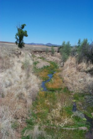
Santa Cruz River, east of Patagonia, AZ

Santa Cruz River, east of Patagonia, AZ
In the summer of 1848, several companies of US troops were ordered out of Mexico. One of which was the cavalry unit under the command of Major Lawrence P. Graham. His company, with a few wagons, traveled north from Janos, Chihuahua up to present day New Mexico, and over the rugged Guadalupe Pass into present day Arizona.It is from Lt. Cave Johnson Couts, an officer in Graham's command who kept a detailed journal of the journey, that the details of Major Graham's route is known. In October, 1848, they found the road blazed by Lt. Col. Philip St. George Cooke and the Mormon Battalion, following it west to the San Pedro River. The company turned north and traveled down the San Pedro to where the Babocomari River joins the San Pedro at the site of the Spanish presidio of Santa Cruz de Terranate, near present day Fairbank. For some unknown reason, Graham left the established Cooke Road and turn west toward the Santa Rita Mountains. Major Graham's ultimate destination was California, and no one can figure out why he didn't continue on the Cooke Wagon Road . . . some historians say that the motive was strictly ego, and he wanted to have his place in history as creating the "Graham Wagon Road." Others say he was just inebriated most of the time.
Graham's command followed the Babocomari River. After about 12 miles they were forced to halt by the impassible Santa Rita Mountains. (Photo to the left along the Graham Route) From this point they turned around, traveling in all four directions, following a circuitous route, according to Couts' journal, before finally heading south, following the Santa Cruz River through the San Rafael Valley to the Mexican town of Santa Cruz.
After reaching the town of Santa Cruz, he looped around to the north, still following the Santa Cruz River, and traveled on to Tucson where he once again found the Cooke's Wagon Route which he then followed to California.
With the discovery of gold in California earlier in the year, many argonauts determined to get a head start decided to travel to California via the Southern routes. The tracks left by Major Graham's wagons, which passed over the road during heavy October rains, were deeply embedded in the mud. For about a year, the ruts clearly marked "Major Graham's Road," and many of the emigrant parties naturally followed them, which ultimately became the main Southwest route to Califonia. In September of 1849, a traveler wrote in his journal, "Why this new road runs here I do not know as, of course, it makes the road so much longer." (H.M.T. Powell, the Illinois Company of Forty-Niners)
The mystery remains as to why Graham chose the route he did, which took three times longer from the San Pedro River to reach Tucson, over the easier and shorter route of Cooke.
Photos taken May 23, 2002 for Geodashing trip.
Getting there is all the fun!
GD11-APOT point located at: 31°42' 09"N, 110° 47' 21"W

Send comments, suggestions or inquiries:
Overland Trail
[Overland Trail | Mapping the Trails | Trails West Links ]
Created and maintained by Elizabeth Larson
Copyright © 1996-2002 All Rights Reserved