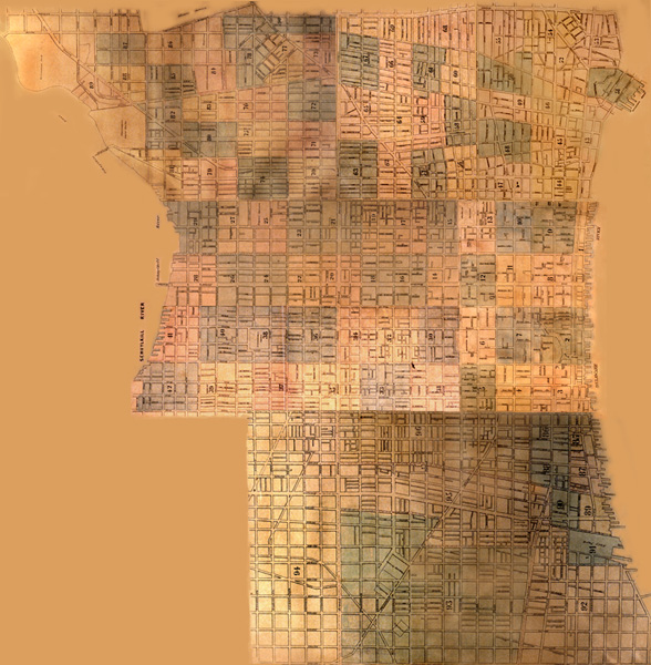
This is a composite of the index plates from the seven volumes at the Free Library, which indicate which of the 97 plates deatils each area. A mouse-click will take you to a larger version of the index plate for a particular volume. So far, only Volume 1 (5th and 6th wards, comprising the blocks located between the Delaware River and Seventh Street, from South Street to Vine Street) link to scans of the individual plates. Individual index plates are also linked textually below the map.