The South Pennsylvania Railroad

Above: Looking west, the South Penn is directly in the center of this shot should it have
been built in Huntingdon County.
The Phenomenal Railroad
by Russell Love
Research
Chestnut Ridge Upper & Lower loops My present focus is locating the right of way down the Chestnut Ridge just west of Donegal. I recently found a landmark on aerial photos which show that I was not locating the railroad in its correct location. I have since found a few more landmarks that show where the alignment should have been built.  Here is a map showing the final landing off the Chestnut Ridge showing at the bottom right hand corner the Ankeny farm with its creeks and one of the creeks exiting the log cabin. Just to the north the grade curves west crosses the only bend in Brush creek and continues straight to/through the Moyer's and Andrews property where you can see on the south end the property line still evident today. That property line is a tree line and is a dead giveaway as to where the railroad should be and my belief is that it is along the south shoulder of the Pennsylvania Turnpike. Notice on the outside curve another property line which can be seen to this day and that boundary also reveals where the railroad would be on today's as well as in the past aerial photos that exist. Here is the whole route that never got built or started in the Chestnut Ridge looking north. 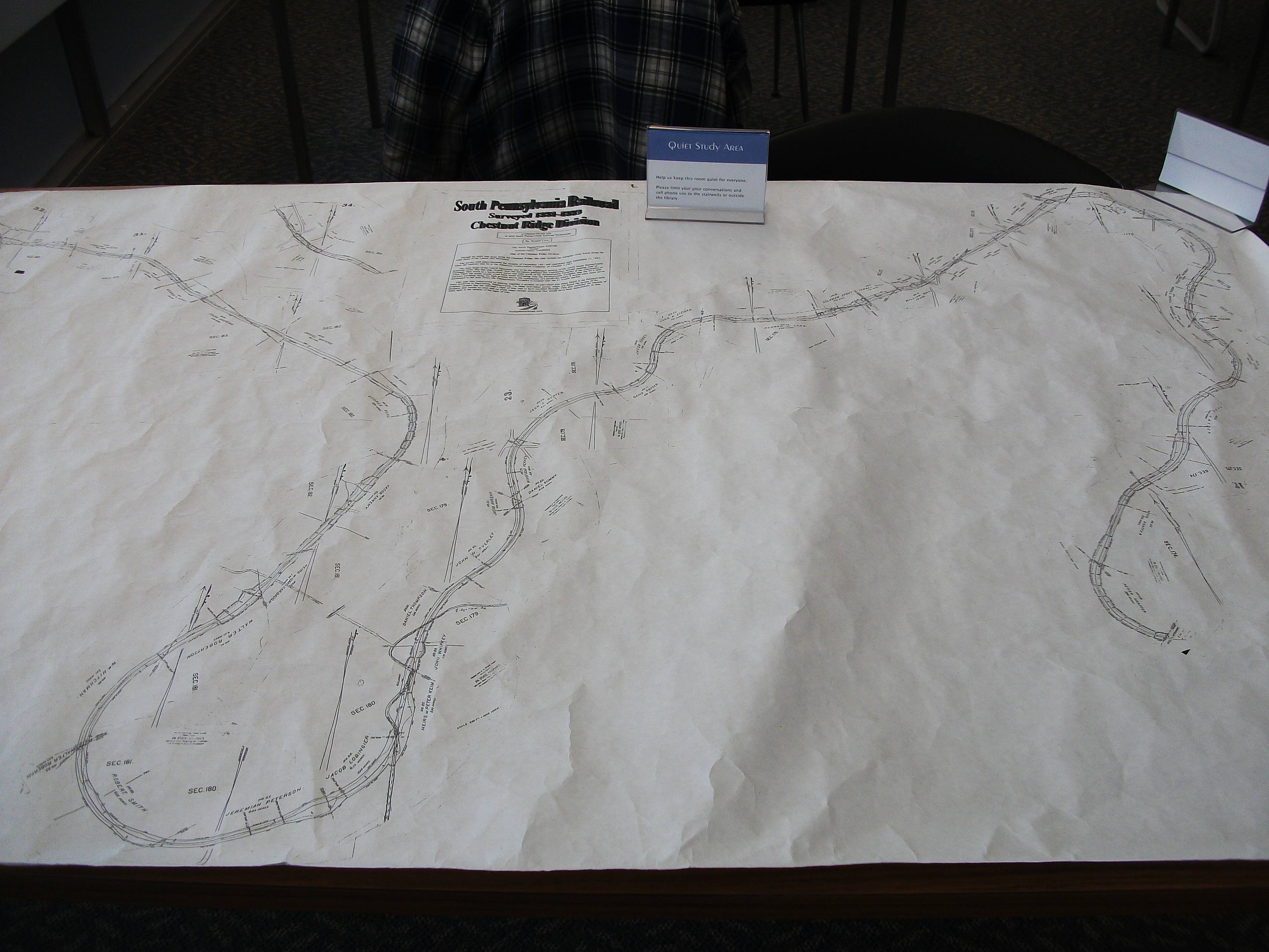 Finding this exact location needs a fly over view. Oh Wait! someone did that already. A June 6th 1939 aerial view of the Chestnut Ridge. Some of the landmarks found on the maps made by the railroad are indeed found on the landscape.  Possible west side of Bedford work Bedford is one of those sites that I keep coming back to. It may seem strange but every time I pass over the intersection of I-99 and route 30 just west of the town I am drawn to focus at the area of the I-99 ramp going north as well as the north bound lanes and keep thinking that is South Penn ground.  This next piece of aerial map shows what appears to be railroad grading along the west bank of the Juniata River just as it appears on the map above. The problem is that parts of I-99 are on top of the site in question. Time to look for culverts.  Bedford Springs Hotel, Bedford Pennsylvania It was once explored that a line to and through the famous historic Bedford Springs Hotel south of Bedfordd was to have the South Pennsylvania Railroad reach and service this site.  Below: You can see on this South pennsylvana Railroad map of the east end of Bedford how a wyw was to be built to access the Bedford Springs Hotel resort.  Phenomenal! |