 Dixie Highway - WestDixie Highway - West
Chicago, IL ![]() Danville, IL
Danville, IL ![]() Indianapolis, IN
Indianapolis, IN ![]() Paoli, IN
Paoli, IN ![]() Louisville, KY
Louisville, KY ![]() Bowling Green, KY
Bowling Green, KY ![]() Russellville, KY
Russellville, KY ![]() Nashville, TN
Nashville, TN ![]() Murfreesboro, TN
Murfreesboro, TN ![]() Shelbyville, TN
Shelbyville, TN ![]() Monteagle, TN
Monteagle, TN ![]() Macon,
GA
Macon,
GA ![]() Americus, GA
Americus, GA ![]() Thomasville, GA
Thomasville, GA ![]() Tallahassee, FL
Tallahassee, FL ![]() High Springs, FL
High Springs, FL ![]() Kissimmee, FL
Kissimmee, FL ![]() Punta Gorda, FL
Punta Gorda, FL ![]() Miami, FL
Miami, FL
 The Hard Way:
Start in Chicago, IL at the intersection of Michigan Ave and
Washington Blvd.
Head south on Michigan to 63rd St
Turn right and head west to State St
Turn left and head south to Marquette St
Turn right and head west to Lafayette Ave
Turn left and head south to Vincennes Ave
Bear right on Vincennes and head southwesterly to Blue Island, IL
Turn right on Burr Oak Ave in Blue Island
Turn left onto Western Ave and head southeasterly
Continue on Dixie Hwy in Harvey, IL
Take Elm Rd over the railroad just south of the Calumet Country
Club
Continue on Dixie Hwy to Chicago Heights
![]() Bear right on Illinois
1 (Chicago Rd) and head south to Danville, IL
Bear right on Illinois
1 (Chicago Rd) and head south to Danville, IL
![]() Turn left and head
east along US 136 to Covington, IN
Turn left and head
east along US 136 to Covington, IN
Turn right on 11th St and head south
Turn left on to Dixie Bee Rd and head east to Veedersburg, IN
Continue on State St
Continue east to rejoin US 136 and head east to northwest of New
Ross, IN
Bear left on Old State Rd
Rejoin US 136 southeast of the Boone / Montgomery County Line
Bear left on to Old State Route 34 southeast of the Boone /
Hendricks County Line
Rejoin US 136 northwest of Lizton, IN and continue southeasterly
to Speedway, IN
Turn right on to Crawfordsville Rd and head southeasterly into
Indianapolis, IN
Bear left on to 16th Street and head east
Bear right on Stadium Dr and head southeasterly into downtown
Continue southeasterly as it becomes Indiana Ave
Bear right on to Capitol Ave
Turn left and head east on Maryland St
The Northern Connector joins in Indianapolis on Maryland / Washington St
The Midwestern Connector joins in Indianapolis on Maryland /
Washington St
Turn right and head south on Meridian St
Bear right and head southwesterly on Bluff Rd to Glenns Valley,
IN
Turn right on Wicker Rd
![]() Turn left on to
Indiana 37 and head southwesterly
Turn left on to
Indiana 37 and head southwesterly
Bear right on to Old State Route 37 northeast of Bluffs, IN
Rejoin Indiana 37 at Crooked Creek
Bear left and head through Bloomington, IN on Business Indiana 37
/ Old State Road 37
Continue south to Needmore, IN
Original route from Needmore to Oolitic,
IN no longer drivable by public
Turn right at Needmore and head west
Turn left on Indiana 37
Turn left on Main Street and head east in Oolitic
Turn right on to Hoosier Ave and head southeasterly
Bear left on to Oolitic Rd
Continue southerly on to Lincoln Ave / L Street
![]() Turn right on 16th
Ave (US 50)
Turn right on 16th
Ave (US 50)
Continue west on 16th Street
Turn right on O Street
Continue southerly on Washington Ave, parallelling US 50
Turn left on R Street
Turn right on US 50 and head southwesterly
![]() Turn left past East
Fork White River on to Old State Road 37 head south, roughly
parallelling Indiana 37 till it joins Indiana 37
Turn left past East
Fork White River on to Old State Road 37 head south, roughly
parallelling Indiana 37 till it joins Indiana 37
Bear right on to Indiana 37 and head south to Mitchell, IN
Take Old State Route 37 through Mitchell and rejoin Indiana 37
south of town
Head south to Paoli, IN
![]() Turn left on to US
150, and head southeasterly to Galena, IN
Turn left on to US
150, and head southeasterly to Galena, IN
Southeast of Galena, bear left on Paoli Pike and head
southeasterly to New Albany, IN
Continue southerly on State St
Turn right on Elm St
Turn left on to US 150 and cross the Ohio River to Louisville, KY
![]() Exit on to US 31W
(Dixie Highway)(Exit 3) and head south to West Point, KY
Exit on to US 31W
(Dixie Highway)(Exit 3) and head south to West Point, KY
Bear right on to Main St
Continue as it curves south and becomes Old Dixie Highway through
Fort Knox, KY
Continue south on Wilson Rd to the north side of Elizabethtown,
KY
Bear right on to US 31W and head south to Horse Cave, KY
![]() Turn right onto
Kentucky 218
Turn right onto
Kentucky 218
![]() Turn left on to
Kentucky 335 (Old Dixie Highway) and head southwesterly to Cave
Creek
Turn left on to
Kentucky 335 (Old Dixie Highway) and head southwesterly to Cave
Creek
![]() Bear right on to US
31W and head west to Bowling Green, KY
Bear right on to US
31W and head west to Bowling Green, KY
![]() Bear right on to US
68 and head west to Russellville, KY
Bear right on to US
68 and head west to Russellville, KY
![]() Turn left on US 431
and head south to north of Springfield, TN
Turn left on US 431
and head south to north of Springfield, TN
Bear left on Old 41
Continue south on Main St
Continue on US 431
South of Springfield, bear left on Old Highway 431
Rejoin US 431 south of Chestnut Grove, TN and head south to
Nashville, TN
![]() Turn left on to US 41
and head southeasterly to La Vergne, TN
Turn left on to US 41
and head southeasterly to La Vergne, TN
Bear right on to Old Nashville Highway and head southeasterly to
Murfreesboro, TN
Continue on College St
![]() Bear right on to US
231 and head south to Shelbyville, TN
Bear right on to US
231 and head south to Shelbyville, TN
![]() Bear left on to
Alternate US 41 and head towards Monteagle, TN
Bear left on to
Alternate US 41 and head towards Monteagle, TN
![]() Continue east on US
41 and head south to Chattanooga, TN
Continue east on US
41 and head south to Chattanooga, TN
The Tennessee Connector joins in Chattanooga, TN along US 41
The Rome Loop
joins in Chattanooga, TN along US 41
Continue southeasterly on US 41 to Dalton, GA
Bear right on Chattanooga Road northwest of Dalton
Continue south on Thornton Ave
Rejoin US 41 and head south to Five Springs, GA
Turn left on to Old Dixie Highway and head to Pratersville, GA
Bear left and continue south on US 41
There is a spur Old Dixie Highway south
of Calhoun, GA
North of the Gordon / Bartow county line, bear right on Old Dixie
Highway
Southeast of Adairsville, GA bear right on to US 41
Bear right on to Old US 41 after Holloway Rd
Bear left on to US 41 north of Farmer Rd
Bear left on Cassville Rd north of Cassville, GA and head south
to Cass Station, GA
![]() Georgia 293 joins
Cassville Rd in Cass Station
Georgia 293 joins
Cassville Rd in Cass Station
The Rome Loop
joins in Cass
Station
Continue south on Cassville Rd to Cartersville
There is a small loop of Old Dixie
Highway between Cassville and Rodgers, GA
Turn left and head east on Cherokee Ave
Turn right on Georgia 293 and head south to Acworth, GA
There
is a local website covering this area
Continue into Acworth on Main St
Bear right on Old Highway 41 / Main St and head southeast to
Marietta, GA
Continue south on Church St / Powder Springs St
Continue south on Atlanta Rd to the Cobb / Fulton County Line
Continue south on Marietta Blvd to Maddox Park in Atlanta, GA
![]() Turn left on
Bankhead Highway (US 278)
Turn left on
Bankhead Highway (US 278)
![]() Bear right on US 41
and head south to Hapeville, GA
Bear right on US 41
and head south to Hapeville, GA
The Georgia Connector joins in Atlanta,
GA along US 41
Cross the railroad tracks and turn left on Henry Ford II Ave
Continue south along Old Dixie Highway
Turn right back on to US 41 (Old Dixie Rd) near Forest Park, GA
Follow US 41 south to Hastings, GA
![]() Turn left on Georgia 3
and head south to Griffin, GA
Turn left on Georgia 3
and head south to Griffin, GA
![]() Continue on Business
US 19
Continue on Business
US 19
![]() Turn left on US 41
south of Griffin and head to Macon, GA
Turn left on US 41
south of Griffin and head to Macon, GA
Continue into Macon on Business US 41
Bear right on Houston Ave and head south
Rejoin US 41
Bear right on Houston Rd and head south to Echeconnee, GA
The Southern Connector joins south of Macon
![]() Bear right on Georgia
49 and head to Americus, GA
Bear right on Georgia
49 and head to Americus, GA
![]() Turn left and head
south on US 19 to Albany, GA
Turn left and head
south on US 19 to Albany, GA
Bear left on Old Leesburg Rd north of Albany and head south into
Albany
Continue south on Jefferson St
![]() Continue south on
Georgia 91
Continue south on
Georgia 91
Turn left on Broad St
![]() Turn right on Georgia
3W (Old Radium Springs Rd)
Turn right on Georgia
3W (Old Radium Springs Rd)
Past Honeysuckle Dr, Georgia 3W is Dixie Hwy
Continue on Old Highway 3 to Camilla, GA
Continue into Camilla on Peachtree St
Bear left on Harney St
Continue as it becomes Old Pelham Rd south of Camilla and head
southward to Pelham, GA
Continue on Martin Luther King Jr. Blvd
![]() Turn left on Georgia
65
Turn left on Georgia
65
![]() Turn right on Georgia
3 and head southeasterly to Thomasville, GA
Turn right on Georgia
3 and head southeasterly to Thomasville, GA
![]() Turn right on to US
319 and head to Tallahassee, FL
Turn right on to US
319 and head to Tallahassee, FL
![]() Continue on Florida
61 into Tallahassee
Continue on Florida
61 into Tallahassee
The North Florida Connector joins in Tallahassee
![]() Turn left on to US 27
Turn left on to US 27
Turn right on to Franklin St
Turn left on to Lafayette St
Bear right on Old St. Augustine Rd
Bear right back on to US 27 and head to Eridu, FL
Turn left on County 14 and head east to Shady Grove, FL
![]() Turn right on US 221
and head south to Perry, FL
Turn right on US 221
and head south to Perry, FL
![]() Turn left on US 27
and head east to High Springs, FL
Turn left on US 27
and head east to High Springs, FL
![]() Turn right and head
south along US 441 to Micanopy, FL
Turn right and head
south along US 441 to Micanopy, FL
Turn right on to Cholokka Blvd (County 25A) and head south
Turn left on SE 165th Ave and head east
Bear right on US 441 and head south to north of Reddick, FL
Bear right on Gainesville Rd and head south
North of Millwood, FL bear right on Dixie Hwy
Continue on Martin Rd
Bear right and return to Gainesville Rd
Continue on Dixie Hwy into Ocala
Cross US 441 and continue south on Magnolia Ave
The Tampa - St. Petersburg Loop joins along Magnolia Ave in Ocala
Continue south on Lake Weir Rd to Camp Roosevelt, FL
Bear left on to US 441 and head south to Belleview, FL
Turn left on Hames Rd
Bear right on SE 110th St
Bear right on County 25A and head to Lady Lake, FL
Bear right on to US 441
Turn right on Guava St
Turn left on Old Dixie Hwy
Bear right on to US 441 and head south to Fruitland Park, FL
Bear right on Dixie Ave
Bear right on US 441 and head to Tavares, FL
![]() Continue south on US
27
Continue south on US
27
Turn left on Dixie Ave
![]() Turn right on to US
441
Turn right on to US
441
Bear left on County 44 and head east to Fort Mason, FL
Turn right on Eustis Rd (County 452) and head to Eustis, FL
![]() Bear right on Florida
19 and head south
Bear right on Florida
19 and head south
![]() Continue on Florida
19A into Mount Dora, FL
Continue on Florida
19A into Mount Dora, FL
Bear left on Heim Rd / 11th Ave
Turn right on Highland St / County 500A
![]() Bear Right on to US
441 and head south to Plymouth, FL
Bear Right on to US
441 and head south to Plymouth, FL
Turn left on Plymouth - Sorrento Rd
Turn right on Highland Ave
Turn right on to Old Dixie Hwy and head east to Apopka, FL
Continue east on Orange Ave
Turn right on Central Ave
Turn left on to US 441 (Main St)
Turn right on Alabama Rd and head south
Continue southeasterly on Apopka Blvd to Lockhart, FL
Turn left and cross US 441 heading east on Beggs Rd
Continue on Edgewater Rd and head south into Orlando, FL
![]() Turn left on US 17/92
(Colonial Blvd)
Turn left on US 17/92
(Colonial Blvd)
The East Florida Connector joins along US 17 in Orlando
Turn right on Orange Ave
Lucerne Circle, around Lake Lucerne, was
the original route of the Dixie Highway before Orange was
extended through the middle of the lake
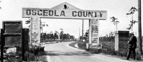
Continue on Old Dixie Hwy at the Orange / Osceola
county line
Turn right on Osceola Pkwy
Turn left on Old Dixie Hwy and head into Kissimmee, FL
Turn right on Donegan Ave
Turn left on Old Dixie Hwy
Bear left on to US 17
Continue south into Kissimmee on Main St
Bear right on Broadway
The Central Florida Connector joins in Kissimmee on Broadway
Bear right on to Emmett St (Old 17/92)
Turn left on Clyde St
Turn right on Penfield Ave
Turn left on on Clay St and head southwesterly
Turn left on CR 531
Turn right on continue west on Old Tampa Hwy
Bear right on to US 17/92
The spur on the right with the 1938
Reedy Creek bridge was bypassed in 2001, it does not reconnect to
US 17.
Turn right on to County 532
Before crossing CSX RR, turn left on to Old Tampa Hwy
This section has the original brick
pavement
At the Osceola / Polk county line, continue on Kissimmee Rd to
Loughman, FL
Turn right on County 54
Turn left on County 547 and head south to Davenport, FL
Bear right back on to US 17 and head south to Haines City.
There is an undrivable portion of Dixie
Hwy between Davenport and Haines City, a spur of which is
accessible from Bates Rd. The asphalt is rough, used as a dump,
and terminates in the back entrance to an equipment salavge yard.
In Haines City, FL, bear right on 15th St (Lee-Jackson Hwy)
Bear left on to 12th St
Turn right on Lily Ave
Turn left on 7th St
Turn right on Jones Ave
Bear right back on to US 17 and head west
The Tampa - St. Petersburg Loop rejoins in Haines City
The Scenic Highlands Highway (connector) joins at Haines City
![]() Turn left on to US 27
and head south
Turn left on to US 27
and head south
![]() Turn right on
Florida 544 (Lucerne Park Rd)
Turn right on
Florida 544 (Lucerne Park Rd)
Bear right on CR 544 (Old Lucerne Park Rd)
Bear right on Florida 544
![]() Turn left on to US 17
and head south into Winter Haven, FL
Turn left on to US 17
and head south into Winter Haven, FL
Continue south along 6th St
Once US 17 is re-aligned in Winter
Haven, you will have to turn right to return to 6th ST and head
south
Turn right on Avenue M
Turn left on to 7th St and head south to Eloise, FL
Continue south on Eagle Lake Rd to Eagle Lake, FL
Continue on 3rd St
Bear right on Crystal Beach Rd
Turn left on to Old Bartow - Eagle Lake Rd
Turn left on to Spirit Lake Rd
Turn right on to Old Eagle Lake Rd and head south to Bartow, FL
![]() Turn left on to US 98
Turn left on to US 98
Continue south on Broadway Ave
Turn left on Hooker St
Bear right with Kissengen Ave and head south
Continue on Old Homeland Rd to Homeland, FL
Turn left on County 640
There is a spur remnant of Dixie Highway
heading south from Homeland signed Old Bartow Rd / Old Fort Meade
Rd that dead ends in land now privately held and partially strip
mined for phosphate.
![]() Turn right on to US
17 and head south to Fort Meade, FL
Turn right on to US
17 and head south to Fort Meade, FL
Turn right on County 630 (Broadway)
Turn left on Sand Mountain Rd on the west side of town
Sand Mountain was a local landmark, a
pile of phosphate tailings that locals treated like beach, with
slopes for tobogganing. It was reclaimed by the phosphate mining
company when refining processes were improved.
Turn right on to US 17
Turn right on to Old Bowling Green Rd and head south to Bowling
Green, FL
An old one lane bridge still exists on
Old Bowling Green Rd over Whidden Creek
Turn left on to County Line Rd
The actual Dixie Highway headed south
from Bowling Green on Dixiana Dr, but the old Wayne Creek bridge
is gone, along with its approaches
Turn right on to US 17 and head south
Turn right on Himrod Rd, south of Wayne Creek
Turn left on Old Dixie Hwy
Bear right on to US 17 and head south
In North Wauchula, FL, turn right on Florida Ave and head south
through Wauchula, FL
![]() Turn left on Florida
64 and head east to Zolfo Springs, FL
Turn left on Florida
64 and head east to Zolfo Springs, FL
![]() Turn right on to US
17 and head south to Arcadia
Turn right on to US
17 and head south to Arcadia
The South Florida Connector joins along US 17 in Arcadia, FL
Prior to the completion of
the Tamiami Trail across the Everglades in the 1920's, the South
Florida Connector was the Mainline western Dixie Highway
Continue south on US 17 to Punta Gorda, FL
![]() Turn left on to US 41
and head to Fort Myers, FL
Turn left on to US 41
and head to Fort Myers, FL
From Ft. Myers to Miami, Dixie Highway
was signed alongside Tamiami Trail. It was the better known local
name and is still prominently signed along this route.
South of Fort Myers, turn left on Old 41 Road (CR 887) and head
south through Bonita Springs, FL
Turn left, return to US 41, and head south towards Naples, FL
Turn left with US 41 and head east to Miami, FL
Connects to Dixie Highway East at US 1 in Miami
![]() E-mail me with comments,
corrections, and suggestions
E-mail me with comments,
corrections, and suggestions
TO: Front Page * Connectors * East * Loops
Page first posted November 29, 2001
Page last updated August 23, 2005