Yellow Book Interstate Proposals
Yellow Book Interstate Proposals
Many people know or have heard of the Interstate legislation that was proposed and passed in 1956. This congressional bill ushered in the era of Interstate highway construction. However, earlier in 1947, a plan was devised by then Bureau of Public Roads the forerunner to today's Federal Highway Administration. The plans that were drawn up for the Interstate system at that point were published in a book called "The Yellow Book." Here are the proposal maps for the Interstate system in six cities in Pennsylvania: Allentown, Erie, Harrisburg, Philadelphia, Pittsburgh, and Reading.
Allentown
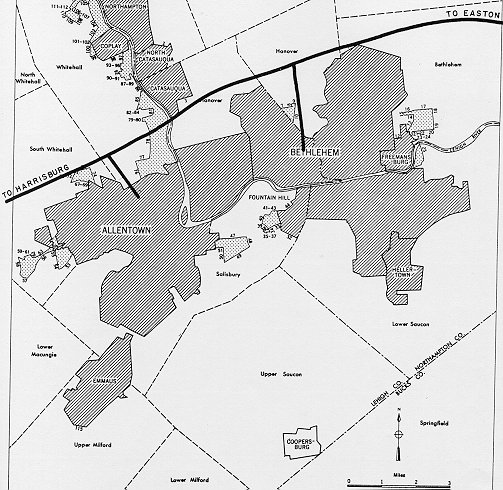
The east-west corridor shown is the Lehigh Valley Thruway, which was to be initially signed as I-78. The spurs off of it into Allentown and Bethlehem were to be I-178 and I-378, whose histories can be found on the Pennsylvania's Decommissioned Interstates page.
Erie
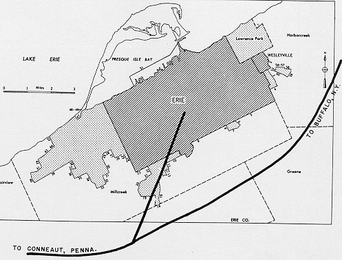
The north-south Interstate proposed would have taken a more direct route into downtown Erie, as opposed to the current I-79 alignment skirting the central business district to the west. The east-west proposed Interstate is very similar to the I-90 alignment.
Harrisburg
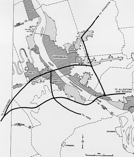
This map is very similar to the layout of the Interstate system in and around Harrisburg. There are two differences between this map and the actual Interstate system. The first is that the north-south Interstate from York is proposed to connect to the Interstate coming through Camp Hill from the southwest at a point closer to the Susquehanna River. The second is that there is no northern bypass of Harrisburg as I-81 provides today.
Philadelphia
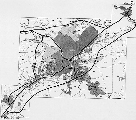
There are some major differences between this map and the current Interstate system in and around Philadelphia. First, the western bypass is only proposed to the Schuylkill Expressway, and not to the Turnpike as I-476 does. Second, the Delaware River Bridge is not indicated on this map. Third, the north-south Interstate is proposed to come through the central business district, unlike how I-95 follows the Delaware River through the city. Fourth, the northern Interstate through the city is located farther to the north than I-676. Lastly, the alignment of the Schuylkill Expressway through the southern section of the city is also located farther north.
Pittsburgh

There is no major difference between this map and the Interstate system in and around Pittsburgh. The biggest difference is that the Interstate from the central business district to the northern suburbs heads straight to the Turnpike, unlike how I-279 connects back to I-79 near Wexford.
Reading
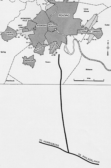
Out of the five maps, this one matches almost exactly what the Interstate system looks like in the city today. The north-south Interstate is close to the I-176 alignment.
Links:
Pennsylvania Interstate Highways
Pennsylvania
Interstate System Route Numberings - Stephen Summers