Lincoln Highway
Lincoln Highway
This is perhaps the most famous of all the US highways in Pennsylvania. US 30 is a part of the Lincoln Highway from Philadelphia to the Ohio border, which was the first paved transcontinental highway in the United States. Carl G. Fisher, the creator of the Lincoln Highway, also had a hand in starting the Indianapolis 500 and developing Miami Beach, Florida.
Many parts of US 30 have not changed in years, while some, especially around the major cities of Pittsburgh and Philadelphia, have changed radically since 1925. In Pittsburgh, the highway followed these routes: current PA 60 from North Fayette into town, Carson Street to the Point Bridge, across the Point Bridge to the Boulevard of the Allies, to Forbes Avenue, to Beeler Street, to Wilkins Avenue, to Dallas Avenue to Penn Avenue and onto Ardmore Boulevard. In Philadelphia, the route followed: Lancaster Avenue to Girard Avenue, to East River Drive, to Spring Garden Street, to 5th (westbound) and 6th (eastbound) to Franklin Square, to head across the Benjamin Franklin Bridge which opened on July 1, 1926.
The 1930s saw a lot of work taking place on the highway. The first major change was the construction of the George Westinghouse Bridge over the Turtle Creek valley east of Pittsburgh and the approaches which began in 1930. The bridge opened on September 10, 1932 and provided a bypass of the congested industrial area below saving motorists 30 minutes. Also, the new alignment for US 30 from Greensburg to Latrobe opened. The new route was constructed to straighten out the highway and, near Latrobe, to avoid the new Latrobe Airport (now the Arnold Palmer Regional Airport).
Work to enhance the highway continued in the late 1930s when many sections of the route were widened. They included west to east: Cliff Mine to Pittsburgh, Pittsburgh to Irwin because of the soon-to-open Pennsylvania Turnpike, Adamsburg to Greensburg, PA 416 to Chambersburg, Gettysburg to PA 41, and Chester County line to Philadelphia.
As the 1940s began, the work to improve the highway continued with the widening of the following sections: Irwin to Adamsburg, and PA 41 to the Chester County line. The projects on US 30 came to an end during World War II, as the country saved its resources for the campaigns. After the war, work started back up with widening taking place on the following sections: small section in Bedford County between PA 96 and PA 31, and a section near Everett in 1947, and the following year on a section between Chambersburg and McKnightstown.
The 1950s saw construction begin on two urban highway projects in both Pittsburgh and Philadelphia, on the Penn-Lincoln Parkway and Schuylkill Expressway respectively. With the coming of the Parkway in Pittsburgh, a proposed extension towards the airport was placed on the drawing boards.
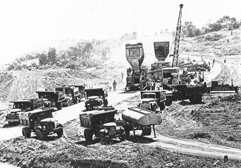
Penn-Lincoln Parkway under construction at the
Campbell's Run
Interchange in 1951. (Clyde Hare)
As those projects got underway, work to widen the highway continued with a section in 1952 between Greensburg and St. Xavier. In 1953, the Penn-Lincoln Parkway opened and with that, US 30 was routed onto the new expressway. However, it was only opened to Bates Street. So, traffic was diverted up Bates onto the Boulevard of the Allies to head into town and to connect to the other open section of the expressway west of the city. For some unknown reason, this original section of US 30 was then marked Temporary US 30.
Widening continued in 1956 when a section from Youngstown to McCance and in Everett was completed. In 1959, the Parkway in downtown Pittsburgh was opened to traffic with the US 30 designation switched to the new expressway, the first section of the Vine Street Expressway also opened as did the section of the Schuylkill Expressway from Girard Avenue to the Vine Street Expressway. For the complete story on the Schuylkill Expressway, see the Interstate 76 page. Work continued on other sections, with widening taking place from Everett to Juniata Crossing and the section from McCance to Ligonier becoming a divided highway. The biggest of the projects to start that year would be the Greensburg Bypass.
In 1960, the Fort Pitt Bridge opened and the Tunnel the following year, and with that the "Temporary US 30" designation was dropped in the Pittsburgh area. For the entire history of the Penn-Lincoln Parkway, see the Interstate 376 and Interstate 279 pages. The Greensburg Bypass also opened to traffic in 1960, while work on the Coatesville-Downingtown Bypass began. In 1962, US 30 was routed onto the Schuylkill Expressway and then onto the Vine Street Expressway, while also changing course to follow 22nd Street to the Vine Street Expressway and then to Vine Street to connect to the Benjamin Franklin Bridge. Also the Coatesville-Downingtown Bypass opened to traffic while work began on the west side of Lancaster on the Lancaster Bypass. In 1964, the remaining section of the Penn-Lincoln Parkway to current PA 978 opened to traffic and the Lancaster Bypass opened to Mountville. Widening also took place in that year from Juniata Crossing to the "Town of Motels," Breezewood. In 1965, US 30 was completely routed onto the Schuylkill Expressway from Exit 342 to the Vine Street Expressway and onto that expressway. While that was taking place, work continued on the expressway between York and Lancaster with the project continuing westward toward Columbia. In 1966, the Lancaster Bypass opened to west of Mountville and with that, the designation of US 30 was placed on the new expressway. The eastern section of the bypass was built in 1951, and was originally signed as US 230. Work began in this year on the McConnellsburg Bypass, which is a two-lane expressway around the town. In 1967, the bypass opened to traffic while work began on the current bypass around York from US 30 west of town to then PA 250 in North York. In 1969, two new project got underway: the Bedford Bypass and the bridge over the Susquehanna River.
In 1966, the Philadelphia City Planning Commission proposed an idea to relieve congestion on the Schuylkill Expressway by building a new expressway. The Main Line Expressway, as it was to be called, would have started at the Schuylkill, continued along Girard Avenue then turn northwest at Lancaster Avenue to City Line Avenue. Construction was scheduled to be started in 1971 and finish in 1976. In the late 1970s, the city officials dropped their plans when they could not get funding from PennDOT.
The 1970s started off with the opening of the Bedford Bypass and the western leg of the York Bypass, and work beginning on the new expressway from Mountville to just north of Hallam. In 1971, work on the York-Lancaster expressway extended to the interchange with PA 74. In 1972, the highway opened from Mountville to Columbia and in 1973 the expressway was completely opened from York to Lancaster, displacing PA 250 through North York.
The 1980s were a slow year for the highway, as many of the new alignment projects had wrapped up. However, construction on a new bypass around Everett began in 1980 and opened in 1982. This section of highway is also known as the Bud Shuster Byway. That's right, "Mr. I-99" was able to secure the funds to build that section of expressway and, as he did on I-99, he put his name on the highway. However, the most important expressway construction project on US 30 began in 1987, when PennDOT revived the Vine Street Expressway project.
The wear and tear on the highway was beginning to show in the 1980s. In 1988, the Greensburg Bypass and a section of US 30 east of the town was rebuilt. These sections were repaved ten years later.
The 1990s saw the completion of the Vine Street Expressway, when it opened on January 10, 1991 at a cost of $225 million. For the complete story on the Vine Street Expressway, see the Interstate 676 page. In 1994, work began to close the gap in the expressway from Downingtown to the US 202 expressway, which opened in 1996. In 1999, the highway was widened and divided from Everett to Breezewood.
PennDOT focused a lot of attention to the highway in the late 1990s and continuing into the early 2000s, with projects aimed at improving the safety of the highway in Westmoreland, Bedford, York, and Lancaster Counties. In Westmoreland County, the project consisted of replacing worn sections of concrete, signs, guard rail, placing Jersey barriers down the middle, widening the highway by a two feet, and repaving. In two instances, traffic signals have been placed at intersections deemed hazardous by PennDOT, one of which was the entrance to my alma mater Saint Vincent College.
The Bedford County project began in the summer of 2001 and will conclude in 2004. The project will involve widening and reconstructing five miles of the highway from east of Bedford to Mount Dallas, rehabilitation of the existing Narrows Bridge, construction of a new bridge next to the current Narrows Bridge, replacing the Turnpike overpass to provide a wider opening for US 30, and replacing a bridge over Snake Spring Valley Run. The project also includes rebuilding four miles of the Bedford Bypass, which involves rehabilitating nine bridges. Project website: http://www.route30bedford.com/.

Seven Mile Stretch in Somerset County (E. Sistek)
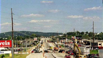
The York County project began on February 17, 1999 involved widening US 30 to three lanes in each direction between I-83 and PA 74. Also involved in the work was the installation of new traffic signals to improve the flow of traffic through this congested area. The work concluded in 2001.
|
|
|
|
|
|
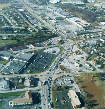
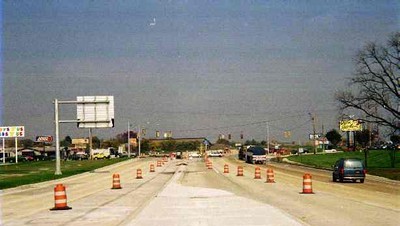
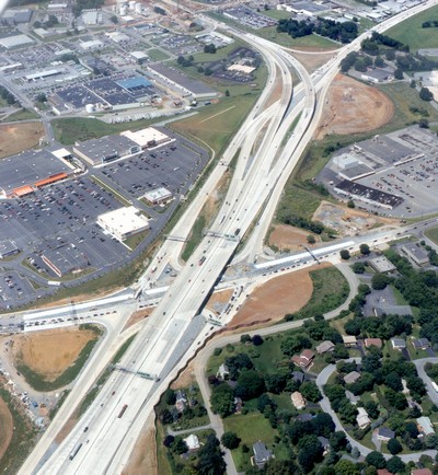
The Lancaster County reconstruction consists of three sections. The "Center Section" project began in January 1997 consisted of widening the highway to three lanes in each direction between PA 283 and US 222. Frontage roads were built along each side of the main lanes to serve local traffic on the Fruitville, Lititz, and Oregon Pikes. New bridges over those highways, sound barriers, retaining walls, and drainage structures were built. Construction concluded in 2000.
|
|
|
|
The Lancaster County "Western Section" project began on March 1, 2000. The highway was rebuilt from Rohrerstown Road to Manheim Pike. The project consisted of resurfacing the highway, new interchanges, new traffic signals, new signing, new pavement markings, and new guide rail. Construction was completed in 2002.
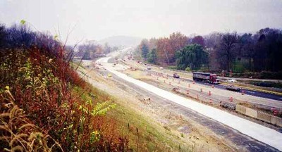
Construction progressing near Conestoga Creek
(PennDOT)
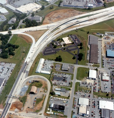
The Lancaster County "Eastern Section" project began in September 2000. The highway was rebuilt from US 222 to PA 462 and cost $87.5 million. The project consisted of resurfacing the highway, new interchanges, new traffic signals, new signing, new pavement markings, and new guide rail. Construction was completed in Fall 2002.
|
|
|
|
The Delaware County construction involves widening the highway to accommodate a center turning lane, resurfacing the highway, and installing new traffic signals. Work began in late 2000 and was completed in 2002. The next phase of work began on July 8, 2003 from PA 340 to the Business US 30 interchange near Downingtown. Construction on this section is scheduled to be completed in late 2004. Project website: http://www.usroute30.com/.
Out of all of the highways in Westmoreland County, US 30 was the scene of the most fatalities between 1989 and 1998 according to the Fatality Analysis Reporting System maintained by the Federal Highway Administration. Fifty people died on Westmoreland County's 41-mile long section of US 30 in those ten years, and 40 between 1995 and 2000. Charles Henaghan, police chief for North Huntingdon said, "Route 30 was never designed to handle the volume of traffic it handles today. Particularly with the topography of our area, you're going up the hill, down the hill and around the bend."
Tragedy hit the highway on the morning of October 26, 2001, when the S.S. Grandview Ship Hotel burned to the ground. The famous Lincoln Highway landmark, located west of Schellsburg in Bedford County, was known not just for being a ship located at the top of a mountain, but also because you were able to see seven counties and three states from its vantage point. See the Grand View Ship Hotel Tribute page for the famous tourist attraction.
A sinkhole developed on the section of expressway known as the Penn-Lincoln Parkway West in North Fayette near the Tonidale Exit on March 7, 2002. The two-foot-deep, 60-foot long dip occurred in the left lane of the highway, but affected the right lane as well. PennDOT blamed mine subsidence for the creation of the sinkhole. Crews worked around the clock to fill the hole with grout, as was done in construction projects in eastern Pennsylvania. All lanes were reopened on March 13.
With the explosion of development in the Robinson Township, improvements to interchanges began. In December 2003, construction began on a $28.8 million project to rebuild the Settler's Cabin Park ramps into a full interchange. The project includes: full interchange between Campells Run Road and the Parkway West, widening and relocating parts of Campbells Run Road, upgrading Ridge and Bayer Roads, and building a six-lane bridge across the Parkway. Reasons for the upgrade are that traffic waiting to exit the Parkway onto Campbells Run Road will back up onto the Parkway. This interchange will be at least the fifth new or improved interchange in the corridor in a decade.
Being that I live within a 100 yards of the route, US 30 and the Lincoln Highway have been a big part of my life. The high school I attended was located on the original Lincoln and the college I attended from 1995 to 1998 was located on US 30. Even my father's life, who also grew up close to US 30, was influenced by the highway. Many times, he and some of the kids from his neighborhood would find an old tire and tie a rope to it to toss out onto the shoulder of the highway. They would wait for a motorist, and thinking they found a perfectly new tire would stop and place it in their trunk. When they were about to close the trunk, that is when the kids would snap the rope and pull the tire back to them. However, this was not as bad as the time they burned down several telephone poles along the highway trying to clear their baseball field. The wind picked up and blew the fire towards the highway.
|
|
|
|
|
|
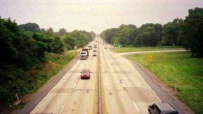
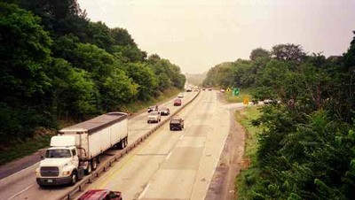
 Westbound in Lancaster at the PA 283 interchange. Years ago this was the beginning of US 230, which PA 283 replaced. |
 Westbound at the Centerville Road interchange. |
 Westbound at the PA 441 interchange in Columbia. |
 Westbound crossing the Susquehanna River, the longest unnavigatable river in the eastern United States. |
 Westbound in York nearing the PA 24 interchange. |
 Westbound in the town of Jennerstown. This intersection is where US 30 and US 219 used to cross one another before the expressway was built east of town. |
 Westbound leaving Jennerstown looking at the summit of the Laurel Ridge. |
 The scene of many terrible head-on collisions over the years. PennDOT rebuilt this sharp curve in the early 1990s. |
 Westbound in the town of Laughlintown. |
 Westbound in the town of Ligonier. |
|
|
|
|
 Westbound after the Interstate 79 interchange. |
 Westbound approaching the the Campbells Run Road Exit. |
 Westbound approaching the Oakdale Exit. |
 Westbound approaching the Hankey Farms Exit. |
 Westbound approaching the exit where US 30 leaves US 22 at Imperial. |
 Eastbound at the Hankey Farms interchange. |
 Eastbound after the Oakdale interchange. |
 Eastbound at the Old Steubenville Pike interchange, which is the old alignment of US 22. |
 Eastbound at the PA 60 interchange in Robinson Township. |
 Eastbound approaching the Campbells Run Road interchange. |
 Eastbound approaching the Interstate 79 interchange. |
 Eastbound approaching the PA 136 interchange in Greensburg. |
 Eastbound at the PA 130 interchange in Greensburg. |
| Lincoln
Highway Heritage Corridor
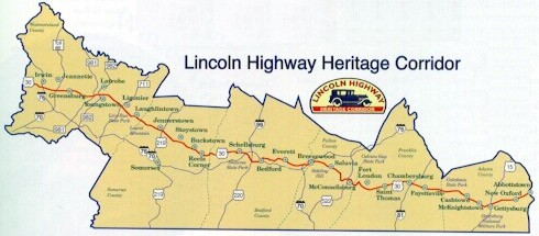
The LHHC is one of nine special heritage areas in the Commonwealth of Pennsylvania. Each is a nonprofit organization designated by Governor Tom Ridge. The Lincoln Highway Heritage Corridor consists currently of Westmoreland, Somerset, Bedford, Fulton, Franklin, and Adams Counties, using the historic Lincoln Highway as a uniting element for preserving scenic, cultural, and historic resources, as well as restoring and developing existing and new programs and facilities. The LHHC is the longest of all of nine heritage parks, extending 150 miles across western and central Pennsylvania.
Website: http://www.lhhc.org/ The corridor has also started resigning stretches of the Lincoln Highway with the old red, white, and blue striped shields with the large blue "L" on them. For a nominal fee of $30, an individual can "adopt" one of these signs to be placed somewhere along the original Lincoln Highway within the corridor. Pennsylvania Highways has adopted one, which is located to the west of Jennerstown at the intersection of an old section of the Lincoln and the current US 30. Below are two pictures of the sign.
|
 PennDOT
Emergency Routing Maps Chester County US 30 Emergency Detours |
Links:
Exit Guide
US 30 Auxiliary Routes
East-West Expressway
Penn-Lincoln Parkway Extension
Route 30 Relocation
Lincoln Highway Association
The Lincoln Highway National Museum and Archives
Lincoln Highway Special Resource Study
Lincoln
Highway State Heritage Corridor
Route 30 Corridor Improvement Study
Benjamin Franklin Bridge
- Delaware River Port Authority
Benjamin
Franklin Bridge - Independence Hall Association
Benjamin
Franklin Bridge - Steve Anderson
Breezewood
and Abandoned Turnpike - Doug Kerr
Field
Notes-Squirrel Hill Tunnel and Penn Lincoln Parkway East - Bruce Cridlebaugh
I-676 Vine
Street Expressway Pictures - Alex Nitzman
Lincoln Highway - Brian Butko
Lincoln Highway - James Lin
Lincoln
Highway - Doug Pappas
Lincoln Highway
Remnants - Adam Prince
Main Line Expressway - Steve Anderson
Penn-Lincoln
Parkway East Structure Tour - Bruce Cridlebaugh
Schuylkill Expressway
- Steve Anderson
Squirrel Hill Tunnel - Bruce Cridlebaugh
'Tard of the Month: May
1998-US22/US 30
Reconstruction
Terminus of US 30 - Dale Sanderson
US 30 Expressway - Steve Anderson
US 30
Junction List - Tim Reichard
US 30
Pictures
- Andy Field/Alex Nitzman
Vine Street Expressway -
Steve Anderson
Westinghouse
Bridge - Bruce Cridlebaugh
Yahoo!
Groups: Lincoln Highway
 INFORMATION |
|
| Western Entrance: |
West Virginia state line four miles west of Hookstown. |
| Eastern Entrance: |
New Jersey state line in Philadelphia. |
| Length: | 320 miles |
| National Highway System: |
From Imperial to the New Jersey state line. |
| Names: | Lincoln Highway Penn-Lincoln Parkway: US 22 west to Exit 8A of I-376 Schuylkill Expressway: Exit 342 to Exit 344 of I-76 Vine Street Expressway: I-76 to the New Jersey state line |
| SR Designations: |
SR 0030 SR 0022: Imperial to I-79 SR 0279: I-79 to Exit 6A SR 0376: I-279 to Exit 8A SR 0070: Breezewood SR 0076: Exit 343 to I-676 SR 0676: I-76 to the Ben Franklin Bridge |
| Counties: | Beaver, Allegheny, Westmoreland, Somerset, Bedford, Fulton, Franklin, Adams, York, Lancaster, Chester, Delaware, Montgomery, and Philadelphia |
| Concurrent Routes: |
US 22: Imperial to Wilkinsburg I-279: I-79 to Exit 6A Truck US 19: Exit 5B to Exit 6A I-376: I-279 to Exit 8A I-70: Breezewood PA 915: east of Breezewood on Sideling Hill PA 116: Gettysburg US 222: Lancaster PA 23: Walnut Street Exit to Holland Pike Exit in Lancaster I-76: Exit 343 to I-676 I-676: I-76 to the Ben Franklin Bridge |
| Former Designations: |
PA 1 (1911 - 1926) |
 Pittsburgh Belt System: |
Oakdale interchange to PA 60 north. |
  Path of Progress: |
PA 981 near Latrobe to PA 711 in Ligonier. PA 985 in Jennerstown to US 522 near McConellsburg. |
 Washington's Trail: |
PA 8 to PA 148 PA 48 to PA Turnpike 66 |
 Traffic Conditions: |
Fort
Pitt Tunnel - PA 60 (Westbound) PA 60 - Fort Pitt Tunnel (Eastbound) Fort Pitt Tunnel - Carnegie (Westbound) Carnegie - Fort Pitt Tunnel (Eastbound) Downtown - Monroeville (Eastbound) Monroeville - downtown (Westbound) |
 Traffic Cameras: |
Red
Bull (Eastbound) Settlers Cabin (Eastbound) Bishops Corner (Eastbound) Campbells Run (Eastbound) I-279 Interchange (Westbound) I-79 Interchange (Southbound) Rosslyn Farms (Northbound) Carnegie Interchange (Northbound) Greentree Interchange (Northbound) Greentree Hill-Top (Southbound) Greentree Hill-Middle (Northbound) Banksville Interchange (Southbound) Fort Pitt Tunnel Garage (Southbound) Commonwealth Place (Westbound) Ft. Pitt Boulevard (Westbound) Grant Street (Eastbound) County Jail (Eastbound) Birmingham Bridge/Bates Street (Eastbound) Bates Street (Westbound) Swinburne Street (Eastbound) Saline Street (Westbound) Beechwood Boulevard (Eastbound) Commercial Street (Westbound) Swissvale (Eastbound) Edgewood (Westbound) Brinton Road (Westbound) Forest Hills (Westbound) Wilkinsburg (Eastbound) Greensburg Pike (Westbound) Chruchill (Eastbound) Penn Hills (Eastbound) |
 Traffic Conditions: |
St.
Davids - Coatesville City Avenue - Walt Whitman Bridge I-76 - Ben Franklin Bridge/I-95 #211/215-567-5678 |
| Area Codes: | 724/878: Ohio state line to
the Allegheny county line; Westmoreland county
line to Somerset county line. 412/878: Allegheny County. 814: Cambria county line to the Fulton county line. 717: Fulton county line to the Chester county line. 610/484: Chester county line to the Philadelphia county line. 215/267: Philadelphia county line to the New Jersey state line. |