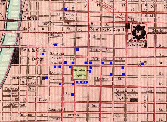
Map of the Rittenhouse Square Area, 1897
Philadelphia, Pennsylvania
The map shown below is a section taken from an 1897 map of the city of Philadelphia. This section represents the Rittenhouse Square neighborhood of Philadelphia, which can roughly be described as the area of the city bounded by Market Street on the North, South Street on the South, Broad Street on the East, and the Schuykill River to the West. The center of the neighborhood is dominated by Rittenhouse Square, one of the four original squares laid out by William Penn in his 1682 Plan for Philadelphia.
In the nineteenth century, the area became one of the most desirable residential neighborhoods in the city and quickly became characterized by elegant mansions and brownstones built by the elite of Philadelphia. Each blue box located on the map below represents one of these elite residences and is linked to a photograph of the residence and a short summary containing the address, original owner, and notable facts regarding the home. This information has been taken from a book published in 1900 by Moses King, entitled, Philadelphia and Notable Philadelphians.