Area of detail in pink.
Bank Row
Philadelphia, Pennsylvania
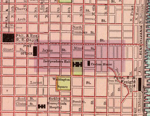
The map of Philadelphia pictured below is based on one taken from the Rand McNally and Company World Atlas of 1897 and focuses on the area of Chestnut St. between Second St. and Sixth St. By the mid-nineteenth century, a large concentration of banks had developed on Chestnut, especially between Second St. and Fifth St., and because of this concentration, this section of of the street became known as "Bank Row." A number of banks in this area were depicted photographically in Moses King's Philadelphia and Notable Philadelphians (New York, 1902).
Area of detail in pink.
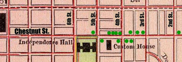
Each of the green circles below provides a link to one of the banks King photographed. The images date from 1900 and are accompanied by a brief caption, which King originally published with the photograph.
Map of Philadelphia by Rand McNally and Company World Atlas, 1897. From the David Rumsey Collection.
Trecia Pottinger
Places in Time
February 2003