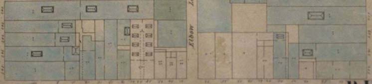
Footprint excerpted from Ernest Hexamer and
William Locher, Maps of the City of Philadelphia, 7 vols.,
(Philadelphia, 1858-62), courtesy of the Free Library of Philadelphia
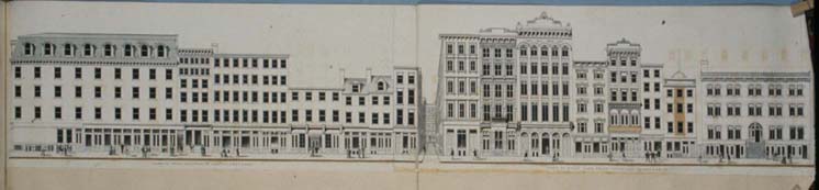
Ink on paper, Dreer manuscript volume of Baxter's panoramic views, c. 1879-80, Historical Society of Pennsylvania
[Closer,
deeper: view diced panoramas and footprints at larger scale,
approx. 3px=1 ft., aligned and linked to additional images and
data on individual buildings]
[Return to intro page, INHP Commercial
Block Historic Reconstructions]