Joseph M. Fox Collection of Watercolor Drawings of Philadelphia
Map of Philadelphia, 1897.
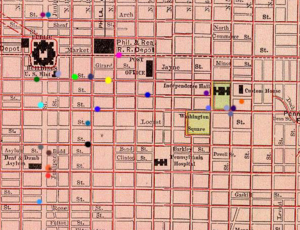
The map below is a section of a map of Philadelphia, Pennsylvania from the Rand McNally and Company's world atlas of 1897. This section represents an area of Philadelphia bordered by Arch Street to the North, South Street to the South, 3rd Street on the East, and 15th Street to the West. Each colored dot represents one of about two dozen watercolor drawings of sites in Philadelphia taken from the Joseph M. Fox collection at Bryn Mawr College.
The drawings date circa 1912-1930. Each dot represents a different drawing and is linked to a picture and information about the watercolor. This collectionwas donated to Bryn Mawr College by Joseph M. Fox, in honor of Emily Fox Cheston, from whose father's collection the drawings originally came. The originals are currently located in the Bryn Mawr College Collections, CC3, "Fox Collection Box."
Map of
Philadelphia by Rand McNally and Company World Atlas, 1897. From
the David Rumsey Collection.
Chelsea Arkin
Image Map Project
City 306
February 21, 2003