RACE THROUGH
PHILADELPHIA !!!!!!!!!!!!

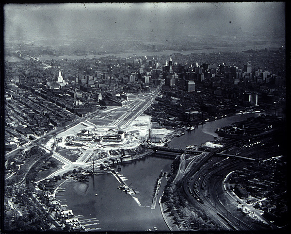
This is an aerial view of the Philadelphia Museum of Art and the Benjamin Franklin Parkway. The museum and the Parkway were part of a huge project at the beginning of this century to add to the architecture and cultural life of the city. This picture was taken in about 1925, when that project was still under way.
Let's look closely at this picture and see what things we can find there. The first thing to notice is the large building in that big open space just above. That is the Museum while it was being built. Next look for the wide street that runs away from the Museum. That's the Benjamin Franklin Parkway. The Parkway connects City Hall, in downtown Philadelphia, to the Museum. If you look carefully, you can see City Hall, a tall building with a white tower, at the end of the Parkway. Along the way to the museum today, you can find many of Philadelphia's famous sites including the Franklin Institute and the Academy of Natural Sciences. Those places weren't all built when this was taken but if you look closely you can see the Free Library of Philadelphia on the left side of the Parkway, about halfway between the Museum. You have also seen that the city Philadelphia is built around two rivers, the Delaware and the Schuykill. Can you find them in this picture? If you can't find some of these places, or want a little help, click here to see a picture with the various buildings and landmarks labeled. To see more aerial views of the city and the surrounding area, please click here. To return to the last page, please click here.