Page Generated 5/13/2003 at 5:46:39 PM
| 24/2/2003 | &c.gif | Ampersand-C ("Etc.") for main menu | |
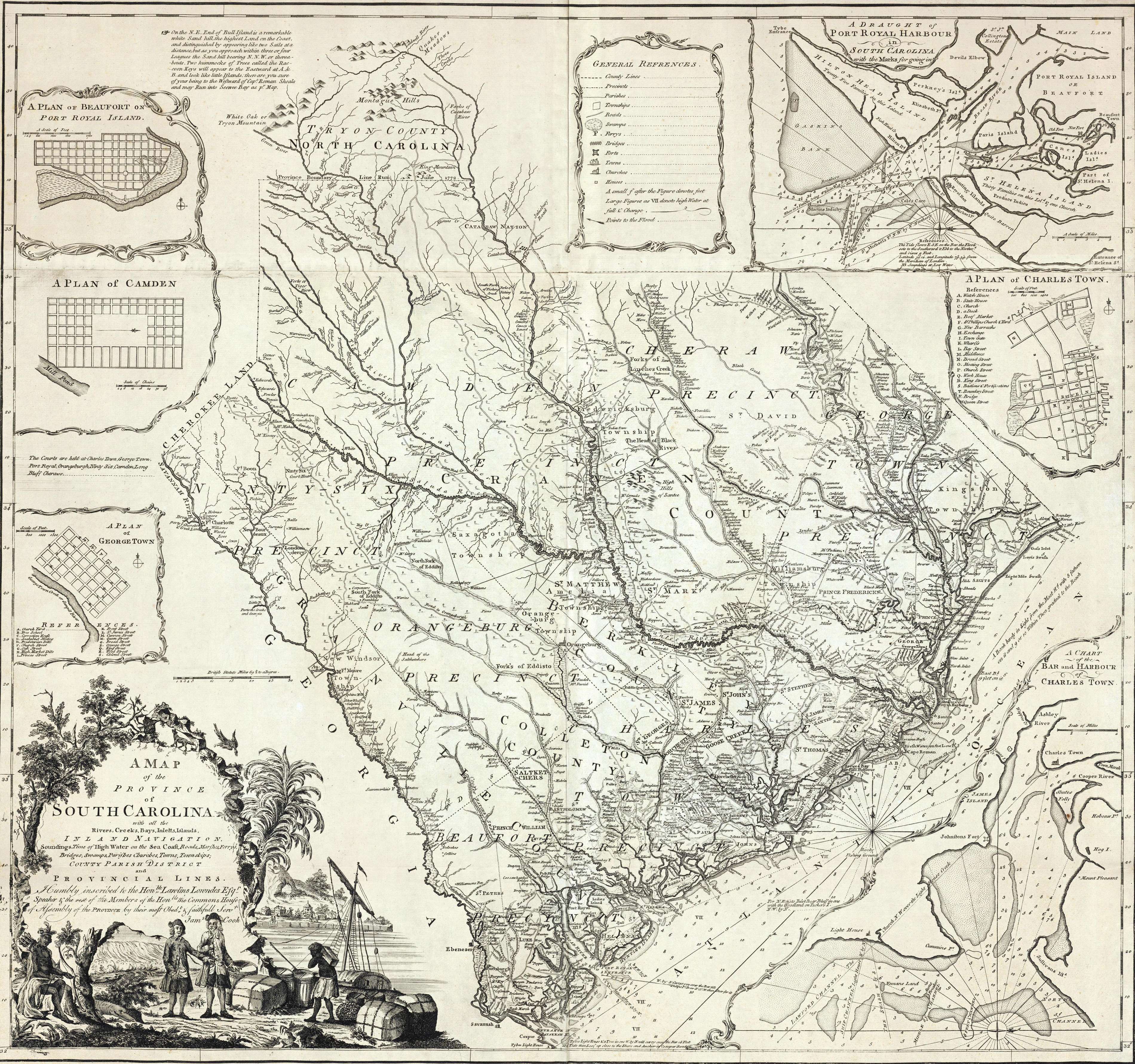
| 26/11/2001 | 1773sc.jpg | Cooks 1773 map of SC [Steven Coker/JAR] | |
| 6/1/2003 | 1779nc.jpg | 1779 NC AniMap | |
| 14/6/2000 | 1825kershaw3.jpg | Mills c1820 map of Kershaw District [Steven Coker/JAR] | |
| 6/10/2002 | 23rd30July1780.gif | Officer roster for 23rd Rgt 30 June 1780 [CBB] | |
| 6/10/2002 | 33rd30July1780.gif | Officer roster 33rd Rgt 30 June 1780 [CBB] | |
| 6/10/2002 | 71st1st30July1780.gif | Officer roster 71st Rgt 1st Batt. 30 June 1780 [CBB] | |
| 6/10/2002 | 71st2nd30July1780.gif | Officer roster 71st Rgt 30 June 1780 [CBB] | |
| 6/7/2002 | aerialtopo.gif | Calvin Keys combo aerial & topo map of Camden site | |
| 13/5/2003 | anderson01.jpg | Thos. Anderson journal, cont., file 2 | |
| 13/5/2003 | anderson02.jpg | Thos. Anderson journal, cont., image file 2 | |
| 13/5/2003 | anderson03.jpg | Thos. Anderson journal, cont., image file 3 | |
| 12/7/2002 | animap.jpg | Animap map showing local SC districts in 1780 [JAR] | |
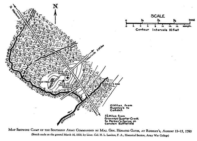
| 10/9/2002 | awc-cam-a.jpg | Landers map of camp at Rugeleys [JAR] | |
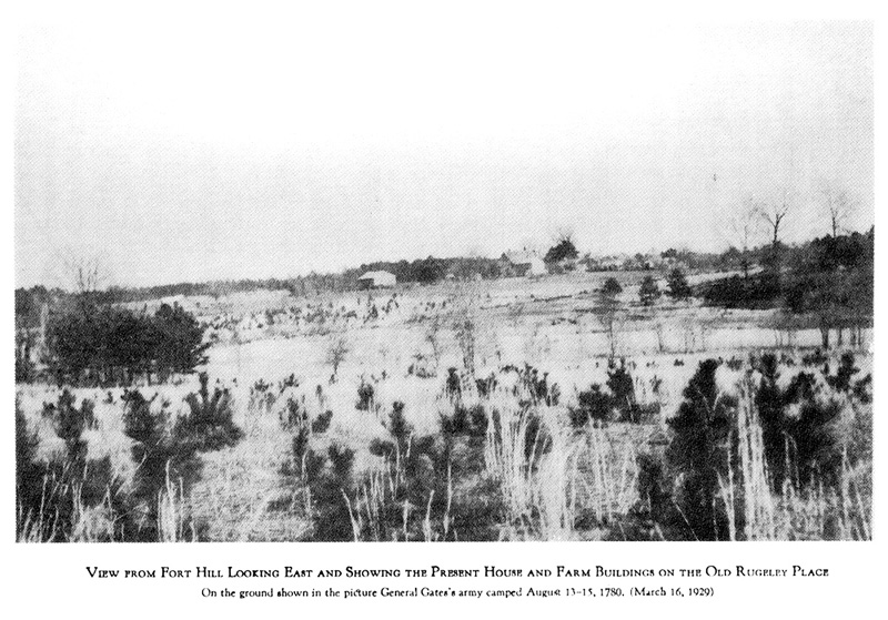
| 10/9/2002 | awc-cam-b.jpg | Present view of Rugeley's 1929 [JAR] | |
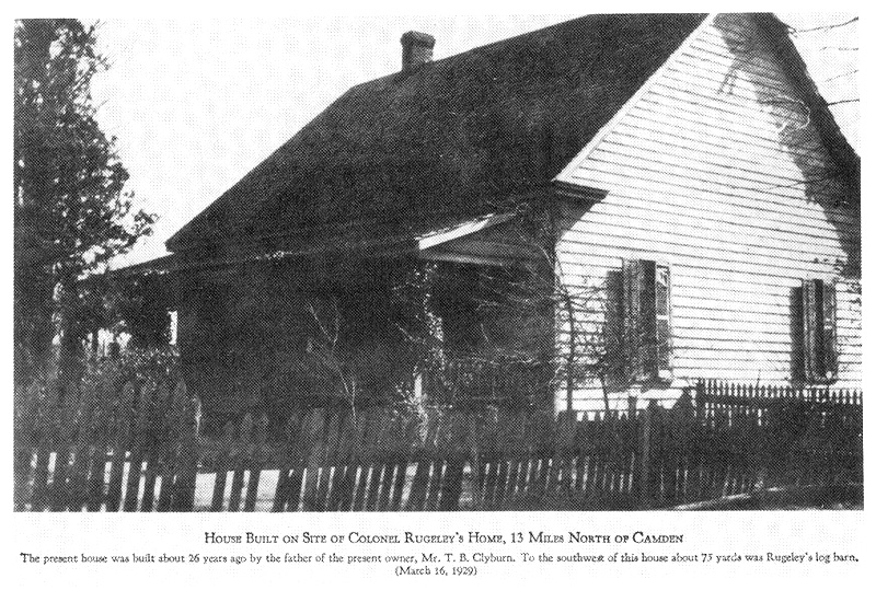
| 10/9/2002 | awc-cam-c.jpg | 1929 house on site of Rugeley's home [JAR] | |
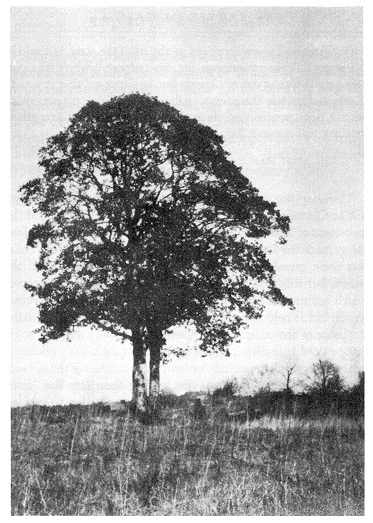
| 10/9/2002 | awc-cam-d.jpg | Tree atop hill at Rugeley's 1929 [JAR] | |
| 10/9/2002 | awc-cam-e.jpg | Gum Swamp 1929 [JAR] | |
| 10/9/2002 | awc-cam-f.jpg | Sanders Creek 1929 [JAR] | |
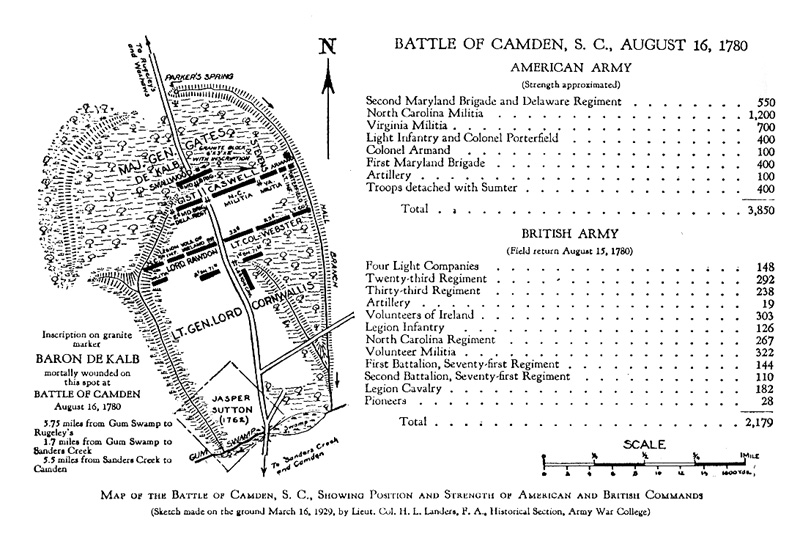
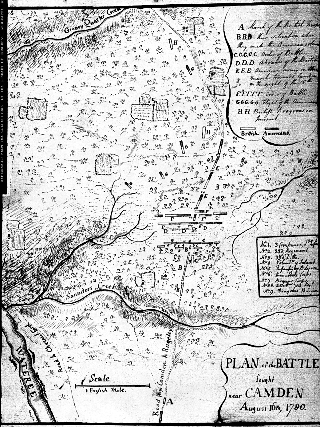
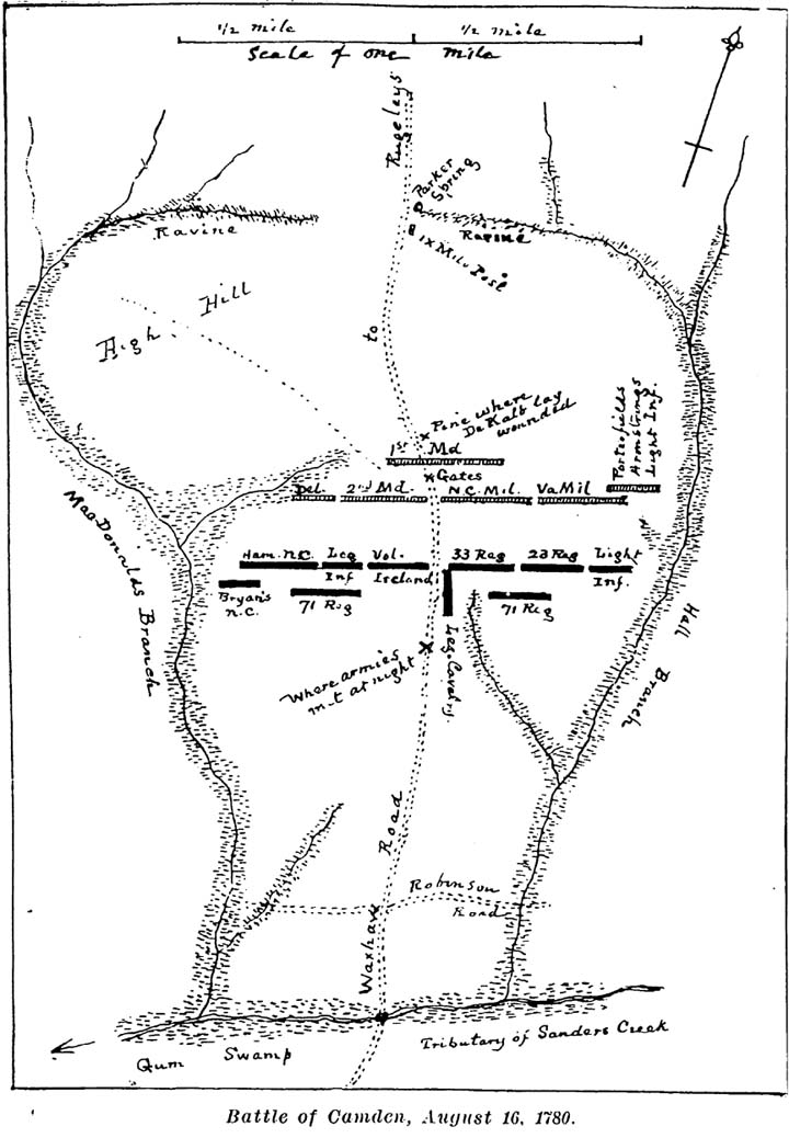
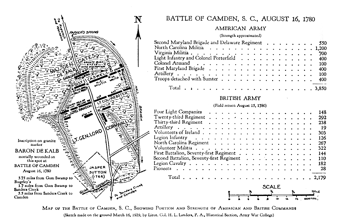
| 10/9/2002 | awc-cam-g.jpg | Landers' map of Battle of Camden [CBB/JAR] | |
| 10/9/2002 | awc-cam-h.jpg | DeKalb monument, Camden, 1929 [JAR] | |
| 19/7/2002 | balls.gif | Artifact images: rifle and musket balls [Calvin Keys] | |
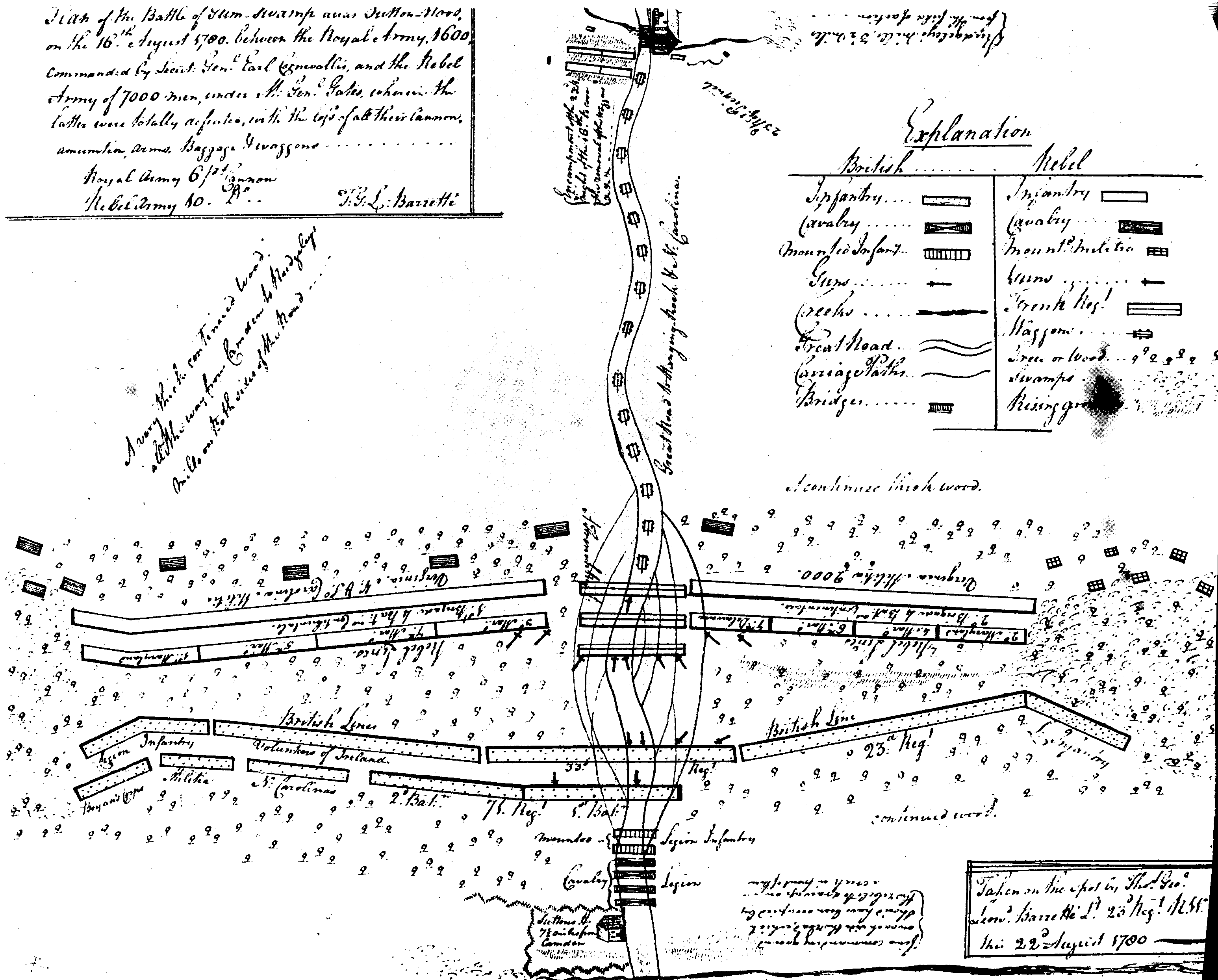
| 1/6/2002 | barrette.gif | Barret�'s battle map [C. \Baxley] | |
| 19/7/2002 | blades.gif | Artifact images: blades [Calvin Keys] | |
| 10/10/2002 | britrgts1780a.gif | Title page (transp), Brit. officer list June 1780 [CBB] | |
| 19/7/2002 | buckles.gif | Artifact images: buckles [Calvin Keys] | |
| 19/7/2002 | buttons.gif | Artifact images: buttons [Calvin Keys] | |
| 6/7/2002 | calvink.gif | Calvin Keys battle map, 1990 | |
| 21/7/2002 | camden_header2.gif | Battle scene on main page header [JAR] | |
| 19/7/2002 | camden_ir.gif | Infra-red image of battle area [CBB] | |
| 18/7/2002 | camden100.jpg | 1:100K topo map of battle areas [JAR] | |
| 18/7/2002 | camden24.jpg | 1:24k topo map of battle areas [JAR] | |
| 21/7/2002 | camden250.jpg | 1:250k topo map of battle areas [JAR] | |
| 13/8/2002 | camdenhm.jpg | Current historical road marker at battle site [JAR] | |
| 13/8/2002 | camdennhl.jpg | Full view National Historic Landmark marker [JAR] | |
| 13/8/2002 | camdennhl2.jpg | Faceplate: National Historic Landmark marker [JAR] | |
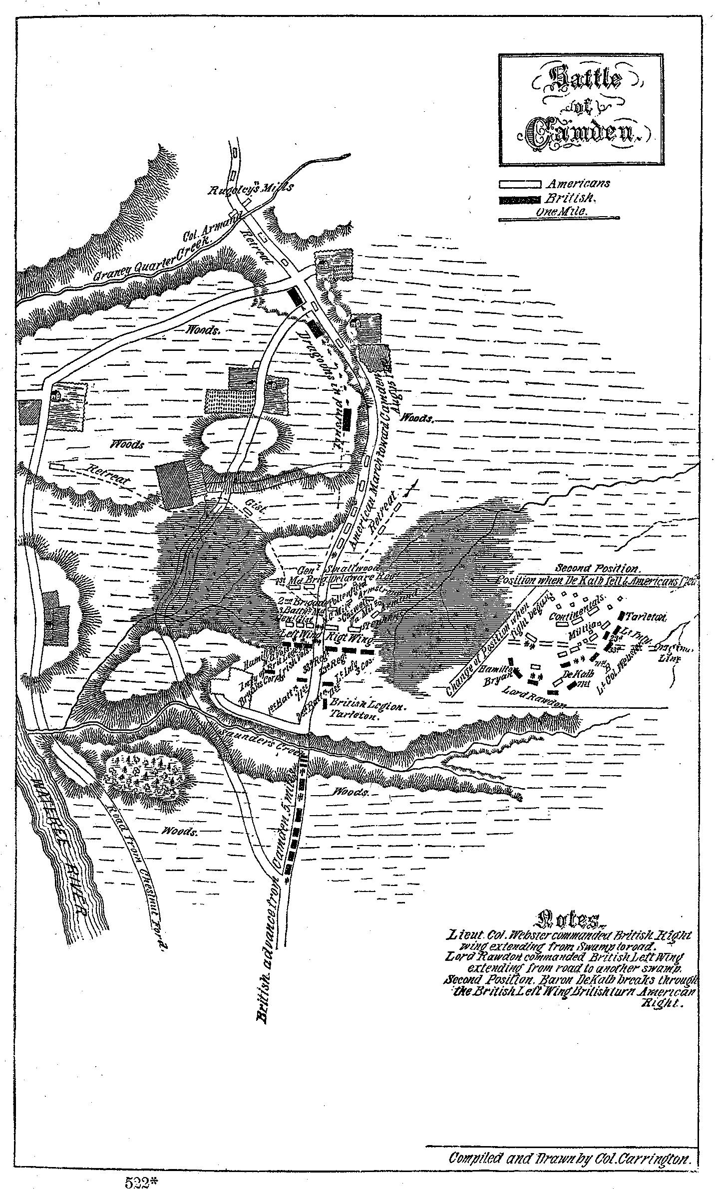
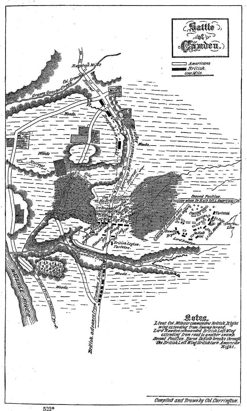
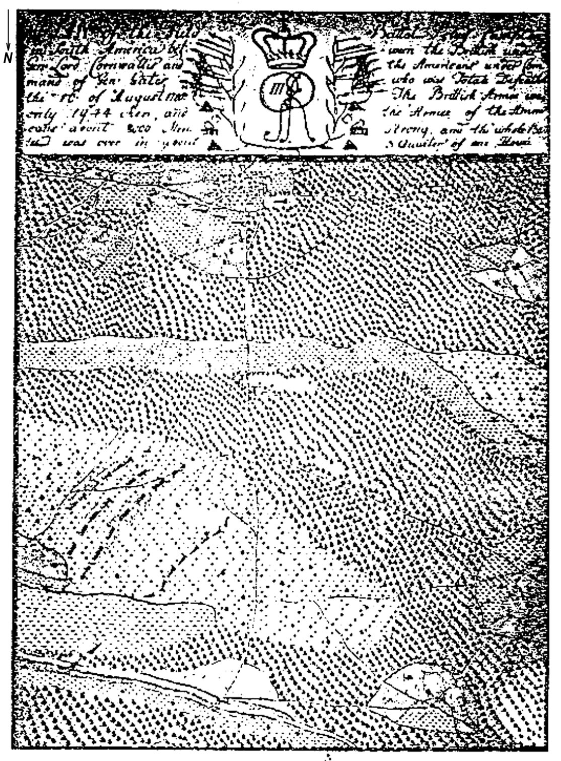
| 8/9/2002 | carrington.gif | Carrington's battle map [CBB/JAR] | |
| 11/9/2002 | carrington_map.gif | Carrington battle map as shown in chapr from book [JAR] | |
| 11/9/2002 | carrington_title.gif | Carrington title page (transp) as seen in chap [JAR] | |
| 20/9/2002 | caswell.jpg | Color portrait of Richard Caswell [JAR] | |
| 20/7/2002 | cornwallisreturn.jpg | Image of Cornwallis 'return' after B of Camden [CBB] | |
| 26/10/2002 | cornwtrav.jpg | Cornwallis/Greene in South | |
| 18/9/2002 | culbertson.jpg | Rbt. Culbertson grave mark as seen with pens stmt [RP] | |
| 23/1/2003 | davie.gif | William Richardson Davie | |
| 23/1/2003 | davie.jpg | William Richardson Davie | |
| 23/1/2003 | davie1798-99.JPG | William Richardson Davie, 1798-9 | |
| 23/1/2003 | davie2.gif | William Richardson Davie (transparent bg) | |
| 25/1/2003 | de_roster01.jpg | Letter from Ralph D. Nelson, Jr, DESSAR | |
| 25/1/2003 | de_roster02.jpg | DE Archives, Military, Vol. 1, title page | |
| 25/1/2003 | de_roster03.jpg | DE Roster, p.115 | |
| 25/1/2003 | de_roster04.jpg | DE Roster, p.116 | |
| 25/1/2003 | de_roster05.jpg | DE Roster, p.117 | |
| 25/1/2003 | de_roster06.jpg | DE Roster, p.118 | |
| 25/1/2003 | de_roster07.jpg | DE Roster, p.119 | |
| 25/1/2003 | de_roster08.jpg | DE Roster, p.120 | |
| 25/1/2003 | de_roster09.jpg | DE Roster, p.121 | |
| 25/1/2003 | de_roster10.jpg | DE Roster, p.122 | |
| 1/2/2003 | de_roster10a.jpg | DE Roster, p.122, landscape | |
| 24/10/2002 | debrahm1757.gif | snippet from DeBrahm, William, 1757 | |
| 31/1/2003 | dekalbgist.jpg | DeKalb, Gist, LaFayette | |
| 13/8/2002 | dekalbmkr.jpg | Current view of DeKalb marker at battle site [JAR] | |
| 17/9/2002 | dememorial.jpg | DE memorial plaque at RW Park, Quaker Cmty. [JAR] | |
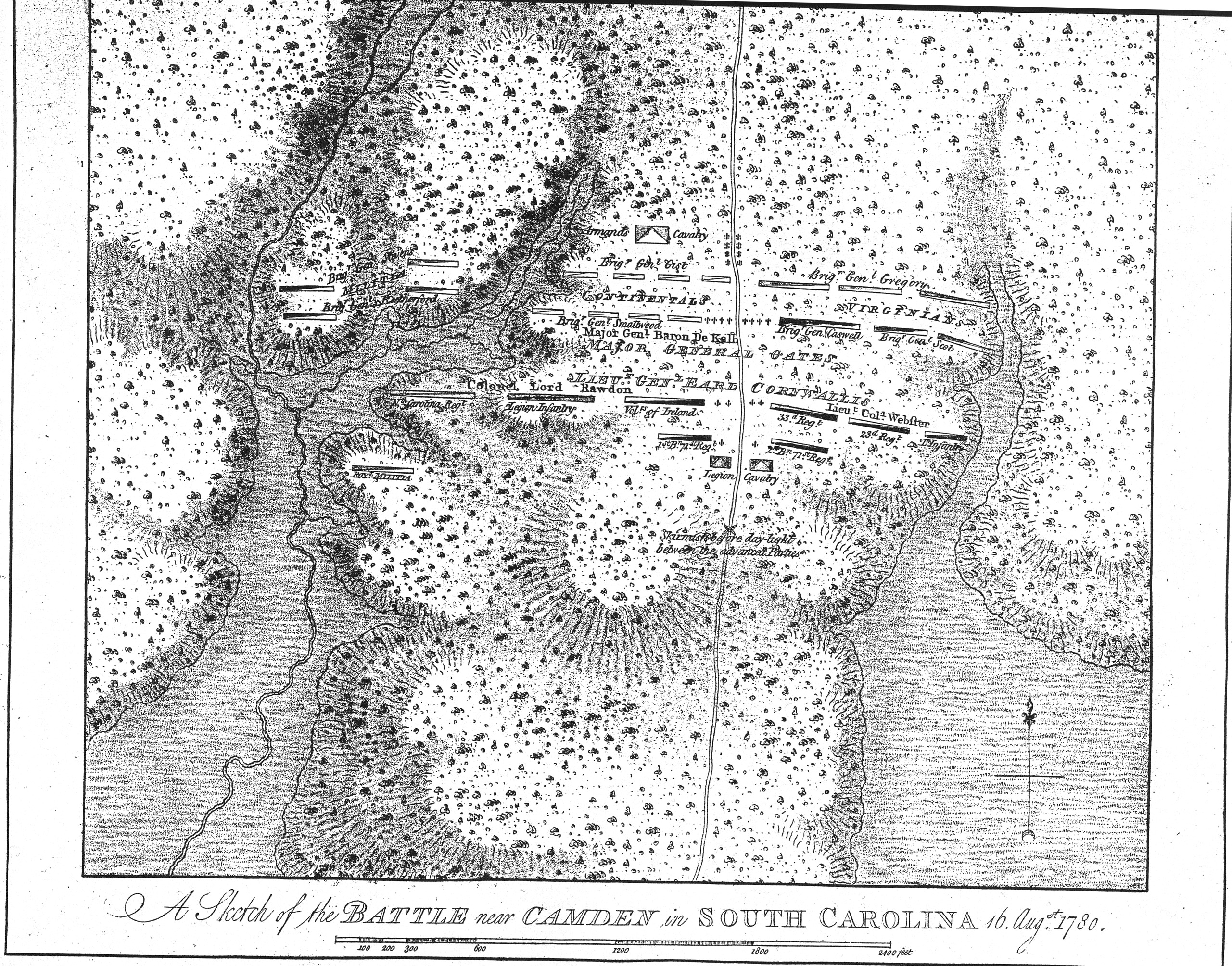
| 13/9/2002 | desbarres.jpg | DesBarres map of battle | |
| 11/2/2003 | duke2.jpg | Duke Cumberland roster? | |
| 13/7/2002 | ed_barron_map.jpg | Ed. Barron's map of the battle [C.Keys] | |
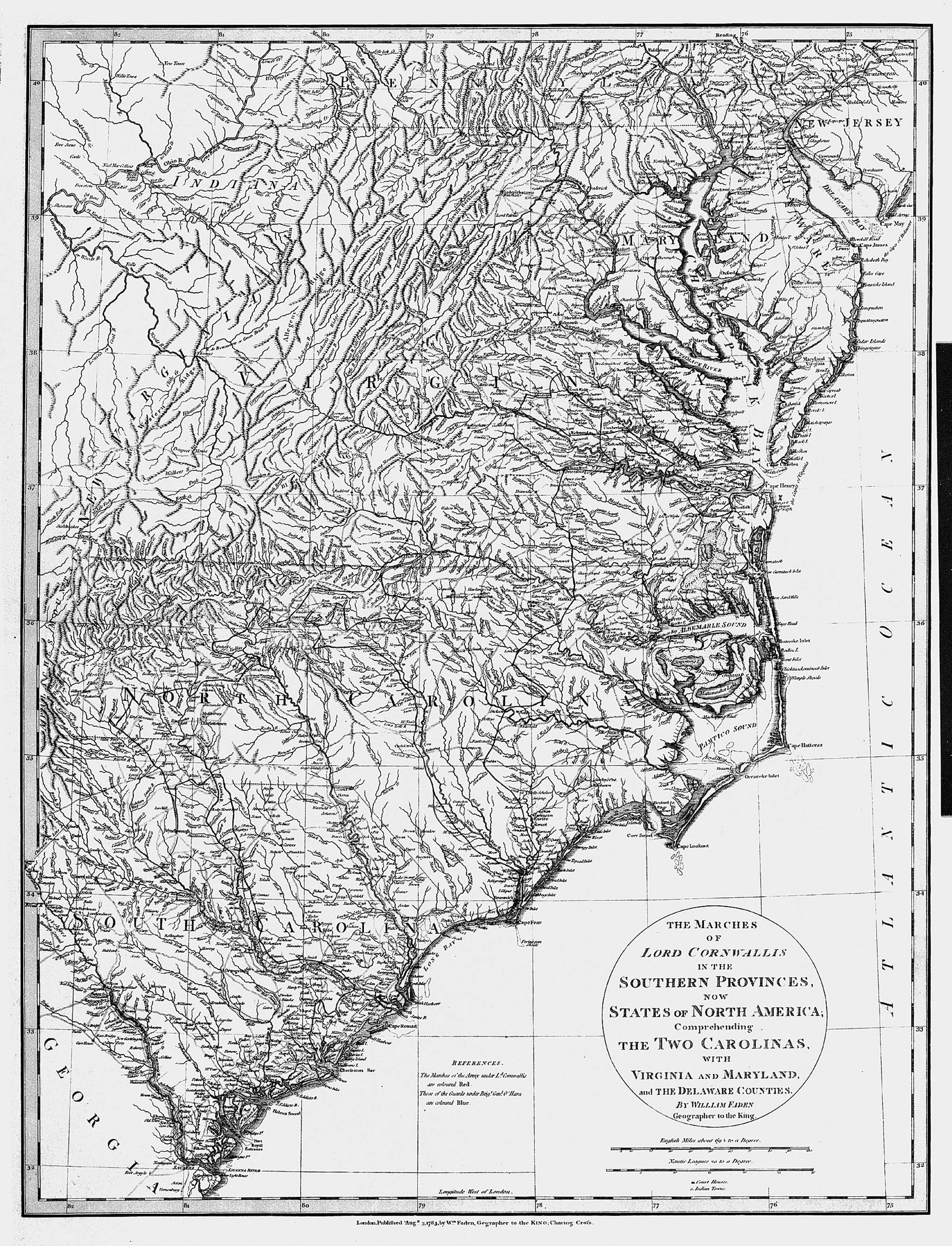
| 26/10/2002 | fadencornw.jpg | Faden: Marches of Cornwallis in South | |
| 9/11/2002 | fadencornw2.jpg | Faden: Cornwallis in S. (smaller) | |
| 17/9/2002 | fadenj_1.jpg | Faden's pen&ink battle map | |
| 1/10/2002 | finnegan.jpg | Battle map by Lt. Finnegan (unreadable) | |
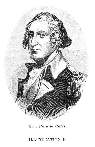
| 17/11/2002 | gates2.gif | Lossing pic of Gates used in Stevens art. (transp) | |
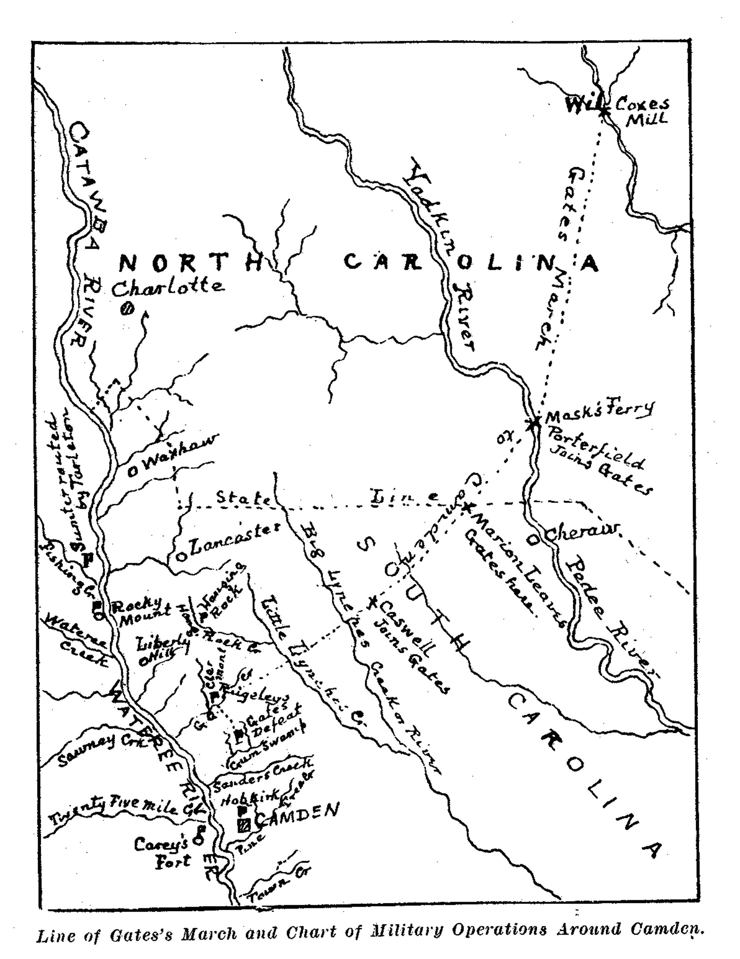
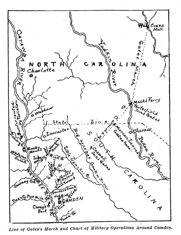
| 12/9/2002 | gatesroute.gif | K&K map of Gates route [JAR] | |
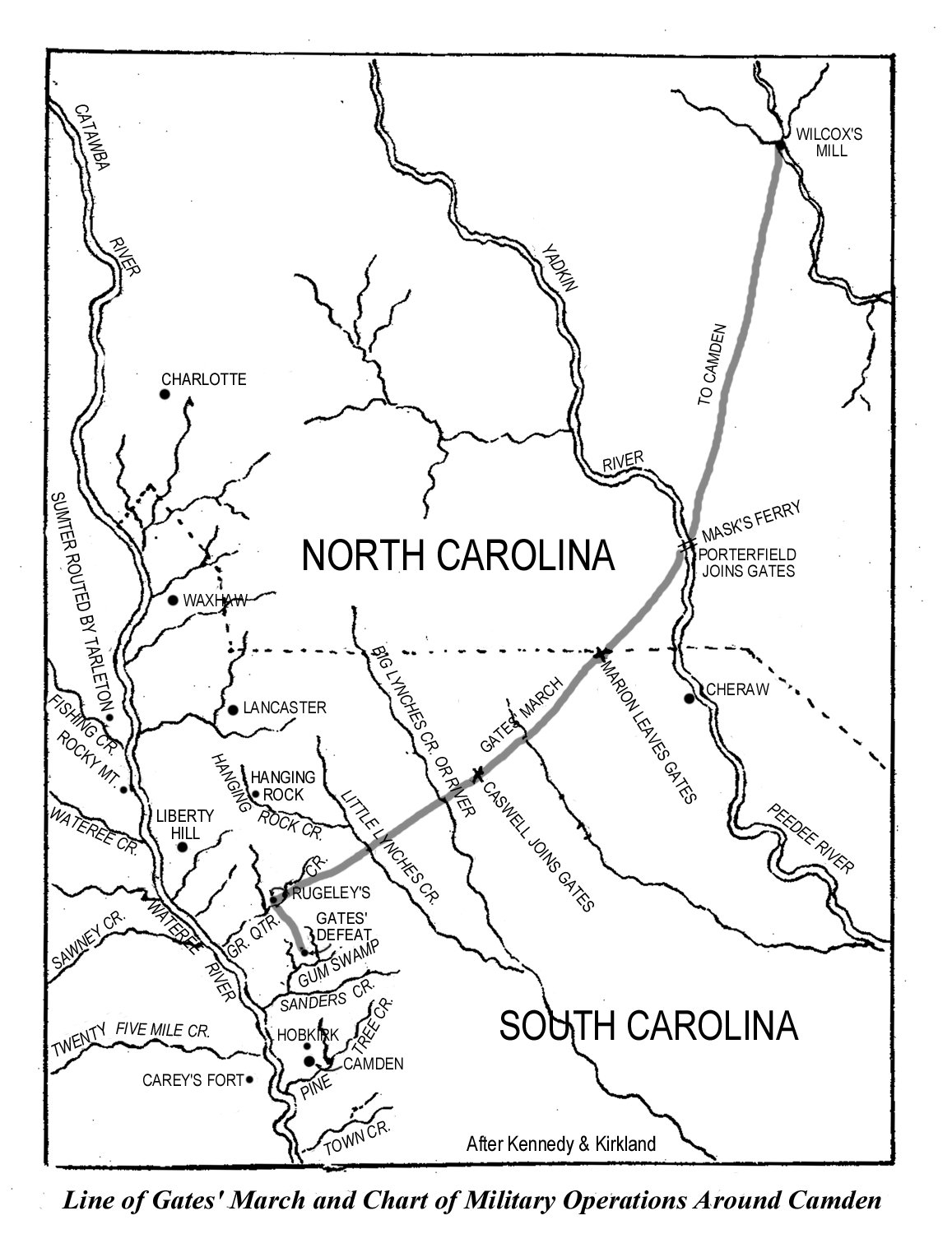
| 12/9/2002 | gatesroute2.gif | K&K Gates route, refurbished by JR | |
| 14/9/2002 | gatesroute4.gif | Gates route as seen in chapter from K&K book [JAR] | |
| 10/9/2002 | gumswamp.jpg | Gum Swamp, Benson Lossing, 1849 [Bill Carr] | |
| 19/7/2002 | guns.gif | Artifact images: guns [Calvin Keys] | |
| 10/9/2002 | hangingrock.jpg | Hanging Rock, Benson Lossing, 1849 [Bill Carr] | |
| 23/7/2002 | headertext1a.gif | Left header text, main page [JAR] | |
| 23/7/2002 | headertext2a.gif | Right header text, main page [JAR] | |
| 18/7/2002 | histmarker.jpg | Old view of historical road marker at battle site [CBB] | |
| 5/10/2002 | johnson.gif | Title page of Wm. Johnson (O.H. Wms. narrative) [JAR] | |
| 19/8/2002 | josiaschall.gif | Image of printed vers. of Josias C. Hall letter [CBB] | |
| 17/11/2002 | jstevens2.gif | Stevens article header (transparent) | |
| 17/11/2002 | jstevensmap2.gif | Stevens article map (transparent) | |
| 25/7/2002 | kalb.jpg | B&w image of De Kalb [JAR] | |
| 25/7/2002 | kennedy.jpg | Kirkland & Kennedy battle map [CBB/JAR] | |
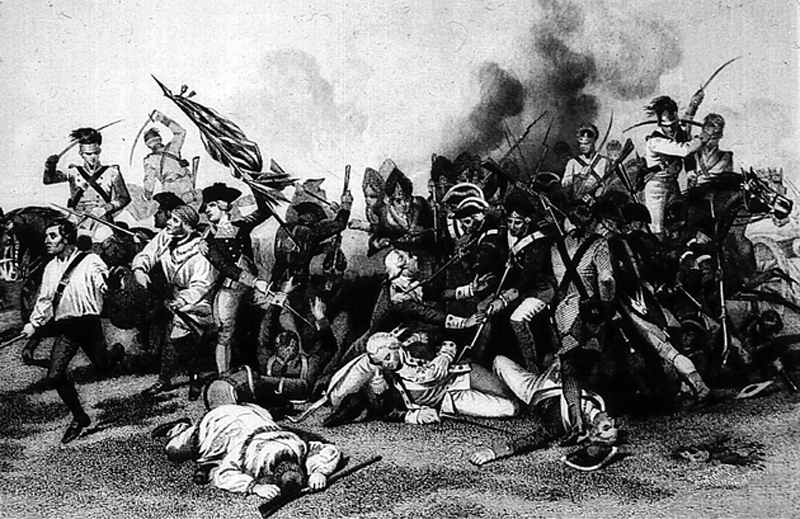
| 13/9/2002 | kkcamden156a.gif | Camden etching as seen in chap. from K&K book [JAR] | |
| 14/9/2002 | kkgates2.gif | Gates pic as seen in chap. from K&K book [JAR] | |
| 13/9/2002 | kktitle.gif | Title page of K & K, "H Camden" as seen in chap. [JAR] | |
| 6/7/2002 | landers.gif | Landers' battle map [CBB/JAR] | |
| 6/9/2002 | lossing.gif | Benson Lossing battle map [CBB/Bill Carr] | |
| 9/9/2002 | lossing01.jpg | Lossing: view at Cherokee Ford, 1849 [Bill Carr] | |
| 9/9/2002 | lossing02.jpg | Lossing: Mountain gorge nr. Cherokee Fd, 1849 [B.Carr] | |
| 9/9/2002 | lossing03.jpg | Lossing: Great falls of the Catawba, 1849 [B.Carr] | |
| 9/9/2002 | lossing04.jpg | Lossing: Rocky Mount, 1849 [Bill Carr] | |
| 9/9/2002 | lossing05.jpg | Lossing: Appearance of the road, 1849 [Bill Carr] | |
| 9/9/2002 | lossing06.jpg | Lossing: Anvil rock, 1849 [Bill Carr] | |
| 9/9/2002 | lossing07.jpg | Lossing: Hanging rock, 1849 [Bill Carr] | |
| 9/9/2002 | lossing08.jpg | Lossing: View at Rugeley's Mill site, 1849 [Bill Carr] | |
| 9/9/2002 | lossing09.jpg | Lossing: View at Rugeley's, 1849 [Bill Carr] | |
| 9/9/2002 | lossing10.jpg | Lossing: View at Rugeley's, 1849 [Bill Carr] | |
| 9/9/2002 | lossing11.jpg | Lossing: View at Gum Swamp, 1849 [Bill Carr] | |
| 9/9/2002 | lossing12.jpg | Lossing: View at Sanders Creek, 1849 [Bill Carr] | |
| 9/9/2002 | lossing13.jpg | Lossing: Baron de Kalb [Bill Carr] | |
| 9/9/2002 | lossing14.jpg | Lossing: De Kalb's monument [Bill Carr] | |
| 9/9/2002 | lossing15.jpg | Lossing: Signature of William Clajon [Bill Carr} | |
| 9/9/2002 | lossing16.jpg | Lossing: General Horatio Gates [Bill Carr] | |
| 9/9/2002 | lossing17.jpg | Lossing: Mordecai Gist [Bill Carr] | |
| 9/9/2002 | lossing18.jpg | Lossing: Battle map as seen in chapter [Bill Carr] | |
| 9/9/2002 | lossing19.jpg | Lossing: William Smallwood [Bill Carr] | |
| 9/9/2002 | lossing20.jpg | Lossing: Abner Nash signature [Bill Carr] | |
| 9/9/2002 | lossing21.jpg | Lossing: Abner Nash's monument [Bill Carr] | |
| 9/9/2002 | lossing22.jpg | Lossing: Edward Buncombe's signature [Bill Carr] | |
| 10/9/2002 | lossing23.jpg | Lossing: example of parole and countersign [Bill Carr] | |
| 10/9/2002 | lossing24.jpg | Lossing: View at spring, Hobkirks Hill, 1849[Bill Carr] | |
| 10/9/2002 | lossing25.jpg | Lossing: Lord Rawdon from an English print [Bill Carr] | |
| 10/9/2002 | lossing26.jpg | Lossing: map of Hobkirk Hill battle [Bill Carr] | |
| 18/8/2002 | mc_esky.jpg | MoonCalc: Eastern sky image [JAR] | |
| 18/8/2002 | mc_moon.jpg | MoonCalc: image of moon [JAR] | |
| 18/8/2002 | mc_ohd.jpg | MoonCalc image: overhead [JAR] | |
| 17/9/2002 | mdmemorial.jpg | MD memorial plaque, RW Park, Quaker Cmty.[JAR] | |
| 17/9/2002 | meritmedal.jpg | Medal of Merit, awarded by Lord Rawdon [CK/MMcG/CBB] | |
| 22/11/2000 | millssc1825.jpg | SC, 1825 Mills Atlas [Steven Coker/JAR] | |
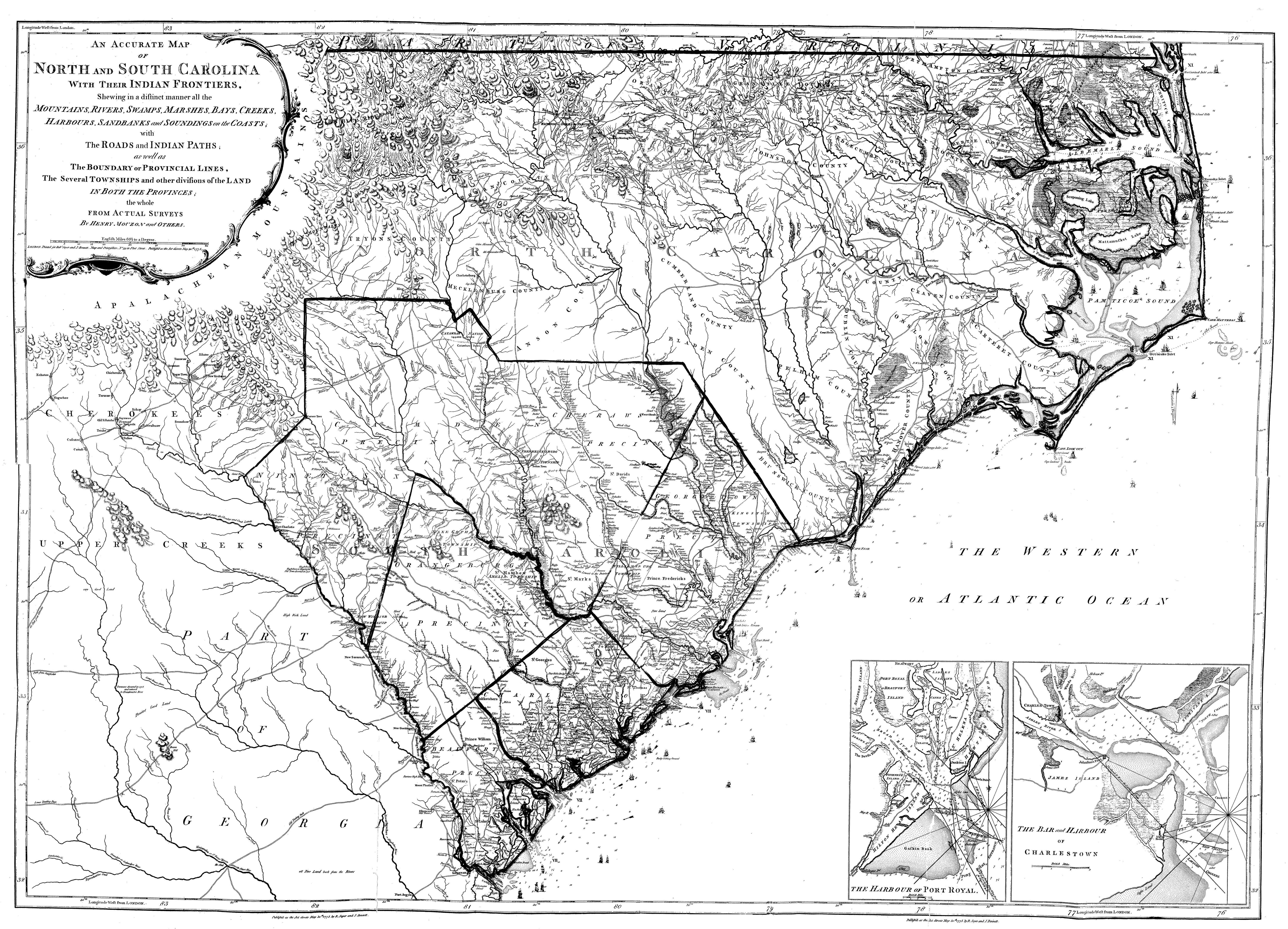
| 27/9/2002 | mouzon.jpg | Mouzon map. 6mb! [South Caroliniana] | |
| 26/9/2001 | new.gif | "New" icon | |
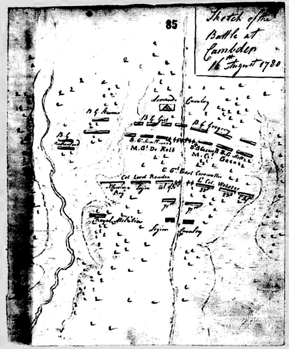
| 6/7/2002 | olive_sketch.gif | "Olive Sketch" battle map [CBB] | |
| 5/4/1999 | parch.jpg | Parchment background used for most pages | |
| 7/1/2003 | qmark.gif | Question mark icon to mark entries needing sources. | |
| 7/1/2003 | qmark2.gif | Question mark icon to mark entries needing souces | |
| 7/1/2003 | qmark2.jpg | Question mark icon to mark entries needing sources | |
| 7/1/2003 | qmark3.gif | Question mark icon to mark entries needing sources | |
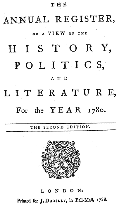
| 13/1/2003 | register.gif | Annual Register title page, 1780 | |
| 13/1/2003 | register2.gif | Annual Register title page, 1780, transparent bg | |
| 16/10/2002 | revolutionary_war_052.jpg | Large version of Camden Battle etching | |
| 16/10/2002 | revolutionary_war_079.jpg | Large image of Gates | |
| 10/9/2002 | rugeleysmap.jpg | Landers map of camp at Rugeley's [CBB/JAR] | |
| 17/9/2002 | rwmemorial.jpg | RW memorial plaque, RW Park, Quaker Cmty[JAR] | |
| 17/9/2002 | rwmemorial2.jpg | RW memorial plaque #2, RW Park, Quaker Cmty[JAR] | |
| 17/9/2002 | rwpark.jpg | RW Park, Quaker Cmty, from across street [JAR] | |
| 18/7/2002 | s&tcamdenproj.jpg | MS Streets & Trips map of battle area [JAR] | |
| 10/9/2002 | sanderscreek.jpg | Lossing: Sanders Creek, larger for printing [Bill Carr] | |
| 6/1/2001 | scroads2000.jpg | SC highways, 2000 [Pat Ruff, Cowpens NB] | |
| 17/11/2002 | senf.gif | Senf map in Stevens article (transparent) | |
| 25/7/2002 | senf.jpg | Senf's map of the battle [J.Legg/G.Fields] | |
| 26/9/2002 | senf2.jpg | "Cleaned-up" version of Senf battle map | |
| 23/10/2002 | seymourcover.gif | Mag. cover for Seymour journal (transparent) | |
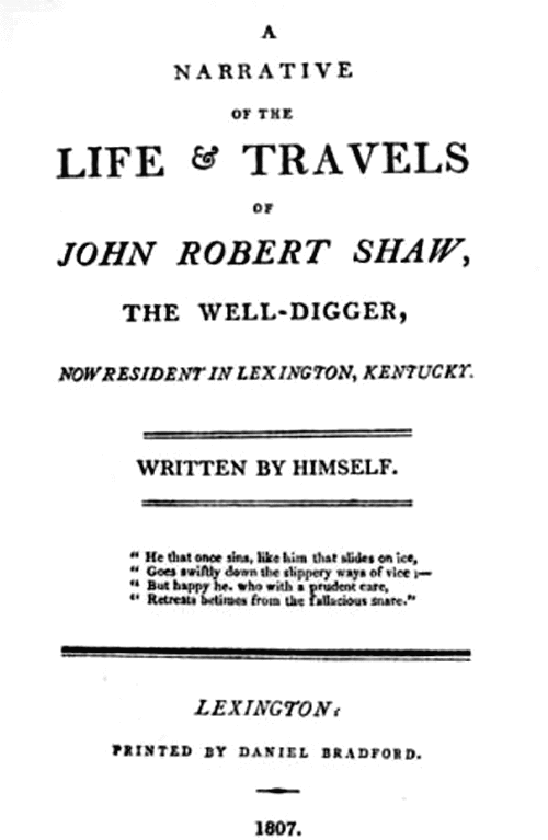
| 6/1/2003 | shaw_orig_title.gif | John Robert Shaw title page, transparent bg | |
| 6/1/2003 | shawself.gif | John Robert Shaw, self-image, transparent bg | |
| 19/7/2002 | shot.gif | Artifacts images: shot [Calvin Keys] | |
| 10/9/2002 | site_ruguleys.jpg | Lossing: Site at Rugeley's, lgr for printing [B.Carr] | |
| 11/9/2002 | south78_81.jpg | Map, Southern area, 1778-1781 [JAR] | |
| 17/11/2002 | stedman.gif | Stedman's map in Stevens article (transparent) | |
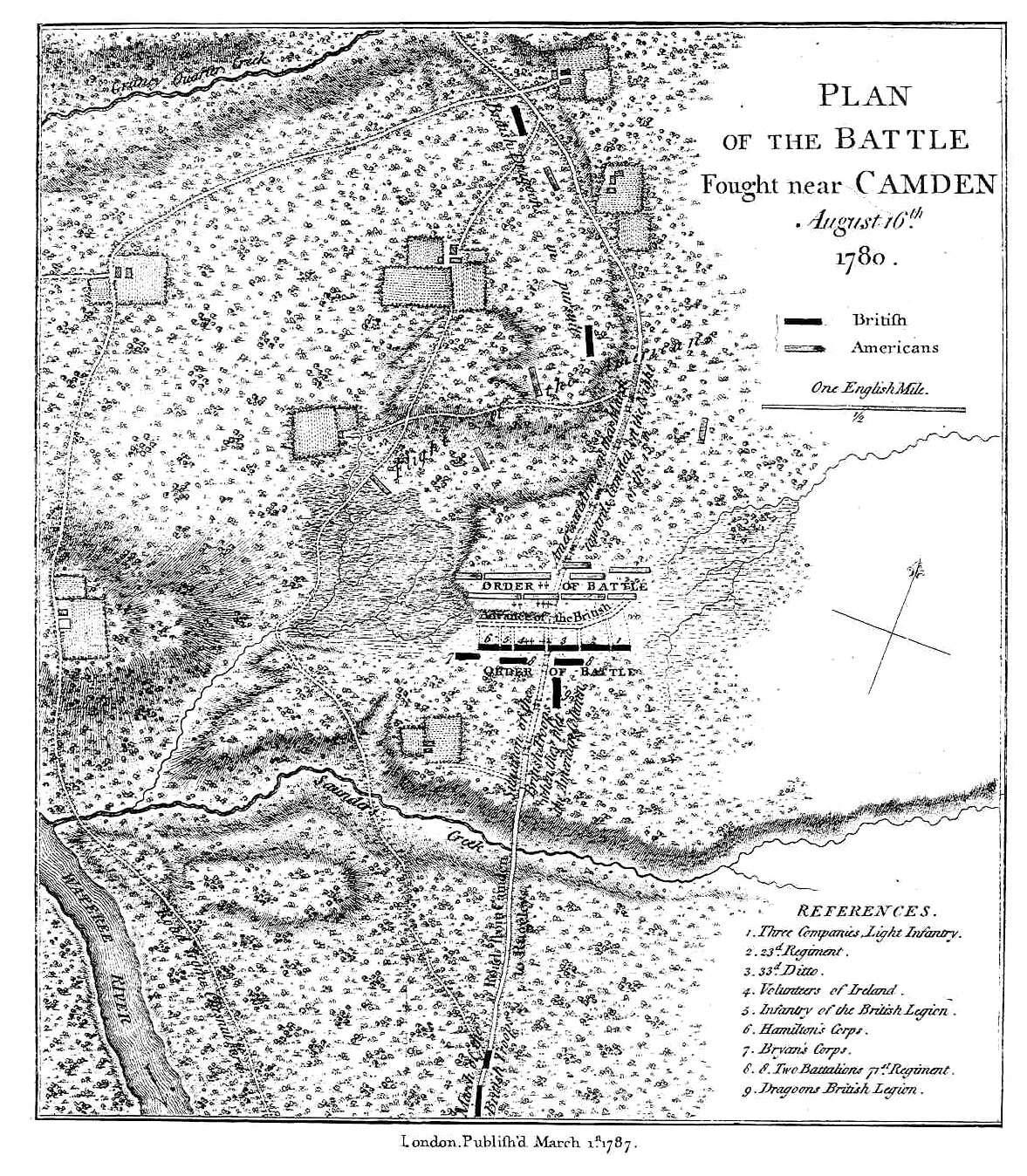
| 25/7/2002 | stedman.jpg | Stedman's map of the battle [J.Legg] | |
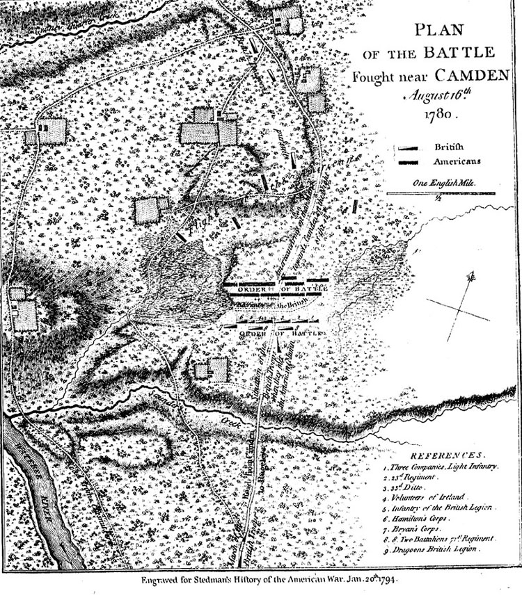
| 29/11/2002 | stedman2.jpg | Stedman's battle map as used with his chapter [CBB] | |
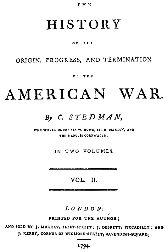
| 10/10/2002 | stedtitle.gif | Stedman's title page as used with chapter [J.Legg] | |
| 17/9/2002 | stoneinwoods.jpg | An old discarded stone in woods behind DeKalb mkr[JAR] | |
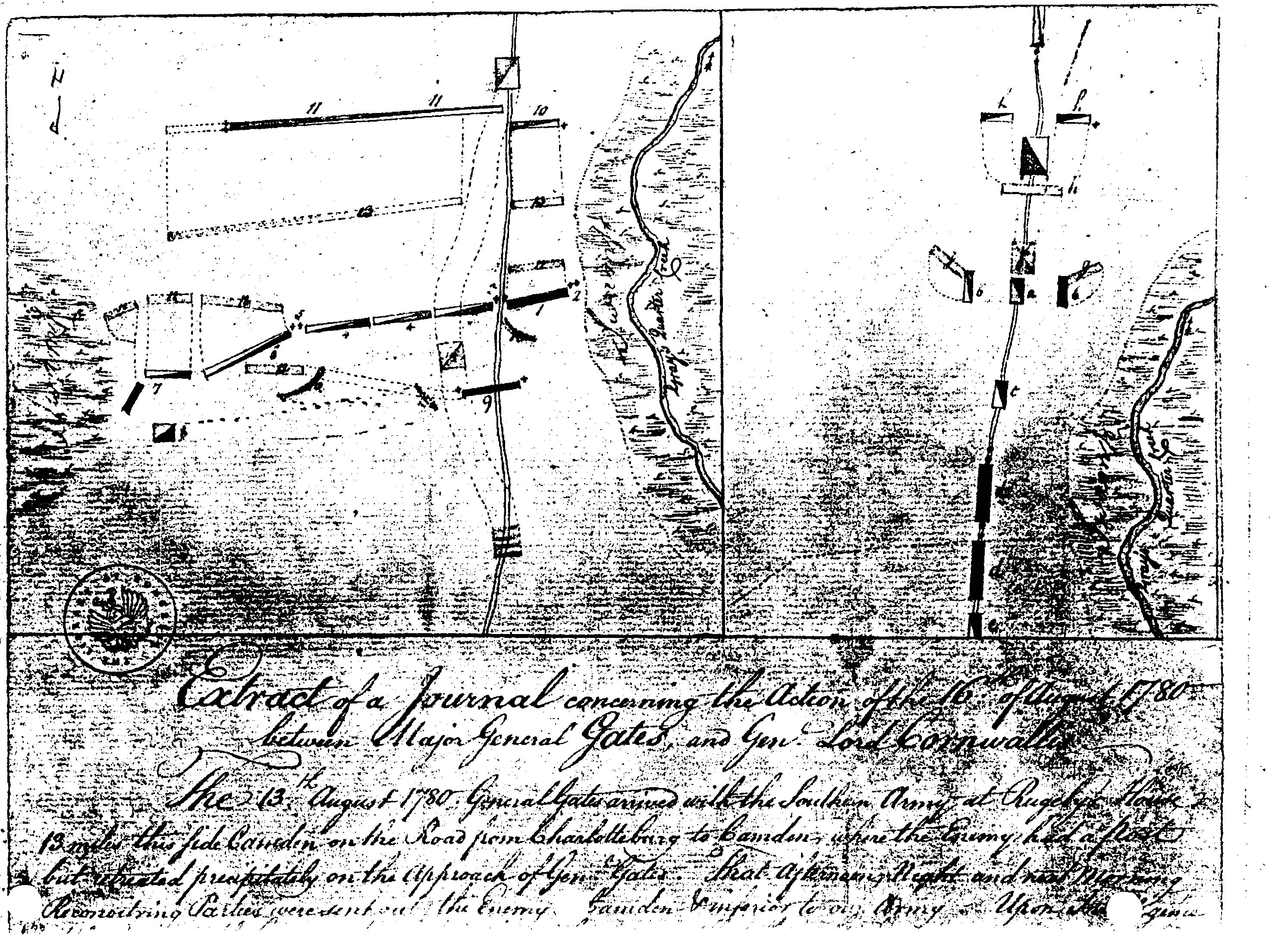
| 6/7/2002 | tarlhist.gif | Battle map from Tarleton's "History" [CBB/JAR] | |
| 16/7/2002 | transoverlaymap.jpg | Calvin Keys battle map with topo overlay | |
| 7/1/2003 | unknown.gif | Question mark icon, for possible use. | |
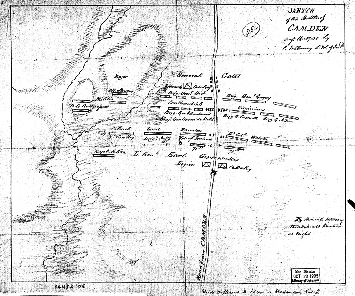
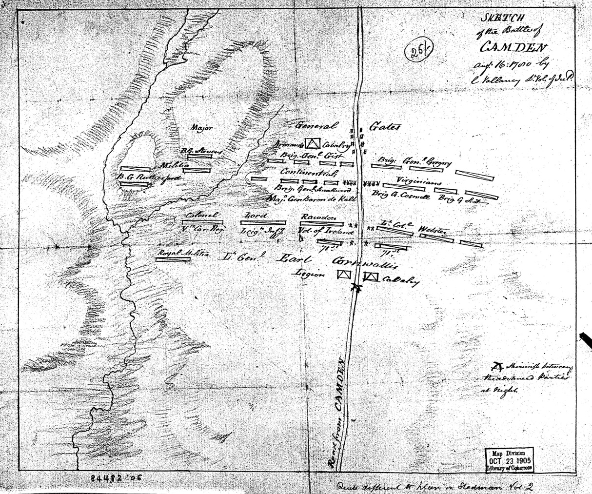
| 16/9/2002 | vallancy.jpg | Vallancy's battle map | |
| 14/9/2002 | vallancy2.jpg | Vallancy's battle map | |
| 10/9/2002 | view_rugeley.jpg | Lossing: View @ Rugeley's, larger for printing [B.Carr] | |
| 13/10/2002 | wc.gif | Web Counter logo | |
| 30/11/2002 | whitfield10.jpg | B. Whitfield: West of battle site markers, 1979 | |
| 30/11/2002 | whitfield11.jpg | B.Whitfield: View south from Battle field markers, 1979 | |
| 22/9/2002 | whitfield5.jpg | B.Whitfield: Original stone tablet over De Kalb's grave | |
| 30/11/2002 | whitfield6.jpg | B.Whitfield: De Kalb monument, 1979 | |
| 30/11/2002 | whitfield7.jpg | B.Whitfield: De Kalb battlefield marker, 1979 | |
| 22/9/2002 | whitfield8.jpg | B.Whitfield: 1956 aerial photo of battle site area | |
| 30/11/2002 | whitfield9.jpg | B.Whitfield: View east of battle site markers, 1979 |
Made with Index Generator 2.4